| DataMB |
Government of Manitoba |
Varies by dataset |
|
| Daylight Saving Time Zones (TZD) |
DMTI Spatial Inc. |
2001 - 2014 |

|
| Digital Elevation Model (DEM) |
DMTI Spatial Inc. |
Various, as derived from NTDB |
|
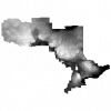
| Digital Elevation Model (DEM) - Provincial Tiled Dataset |
Ontario Ministry of Natural Resources |
2006 - 2015 |
|
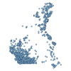
| Disappearing Streams Point |
DMTI Spatial Inc. |
2015 - 2023 |
|
| DMTI CanMaps Content and Postal Content Suite 2024 - full series |
DMTI Spatial Inc. |
2024 |
|
| DMTI Satellite StreetView (SSV) - Alberta |
DMTI Spatial Inc. |
2005 - 2015 |
|
| DMTI Satellite StreetView (SSV) - British Columbia |
DMTI Spatial Inc. |
2006 - 2012 |
|
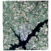
| DMTI Satellite StreetView (SSV) - Charlottetown, Prince Edward Island |
DMTI Spatial Inc. |
2012 |
|
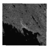
| DMTI Satellite StreetView (SSV) - Iqaluit, Nunavut |
DMTI Spatial Inc. |
2008 |
|
| DMTI Satellite StreetView (SSV) - Manitoba |
DMTI Spatial Inc. |
2005 - 2012 |
|
| DMTI Satellite StreetView (SSV) - New Brunswick |
DMTI Spatial Inc. |
2005 - 2012 |
|
| DMTI Satellite StreetView (SSV) - Newfoundland and Labrador |
DMTI Spatial Inc. |
2005 - 2014 |
|
| DMTI Satellite StreetView (SSV) - Northwest Territories |
DMTI Spatial Inc. |
2008 - 2009 |
|
| DMTI Satellite StreetView (SSV) - Nova Scotia |
DMTI Spatial Inc. |
2005 - 2012 |
|
| DMTI Satellite StreetView (SSV) - Quebec |
DMTI Spatial Inc. |
2002 - 2015 |
|
| DMTI Satellite StreetView (SSV) - Saskatchewan |
DMTI Spatial Inc. |
2005 - 2015 |
|
| DMTI Satellite StreetView (SSV) - Whitehorse, Yukon |
DMTI Spatial Inc. |
2008 |
|
| Dump Region |
DMTI Spatial Inc. |
2015 - 2023 |
|
| Education (EDU) |
DMTI Spatial Inc. |
2002 - 2014 |

|