Geospatial Data
| Title Sort descending | Author | Year | Sample |
|---|---|---|---|
| Land Feature Labels (LLP) | DMTI Spatial Inc. | 2001 - 2014 | 
|
| Land Use (LUR) | DMTI Spatial Inc. | 2001 - 2014 | 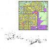
|
| LiDAR Point Clouds - CanElevation Series | Natural Resources Canada | 2022 | |
| Limites législatives des terres autochtones du Canada | Ressources naturelles Canada | 2017 | 
|
| Liquefied Natural Gas Terminals Point | DMTI Spatial Inc. | 2017 - 2023 | 
|
| Liquid Depot Dump Region | DMTI Spatial Inc. | 2015 - 2023 | 
|
| Littoral Line | DMTI Spatial Inc. | 2015 - 2023 | 
|
| Living Atlas of the World | Esri |
Varies by service | |
| Local Delivery Units Look Up Table | DMTI Spatial Inc. | 2015 - 2022 | |
| Local Delivery Units Region (LDU) | DMTI Spatial Inc. | 2015 - 2022 | 
|
| Local Road Casements (LRC) | DMTI Spatial Inc. | 2001 - 2014 | 
|
| Lookouts Point | DMTI Spatial Inc. | 2015 - 2023 | 
|
| Lumberyards Region | DMTI Spatial Inc. | 2015 - 2023 | 
|
| Major Name Points (MJNMP) | DMTI Spatial Inc. | 2003 - 2014 | 
|
| Major Road Casements (MRC) | DMTI Spatial Inc. | 2001 - 2014 | 
|
| Major Roads and Highways (HRD) | DMTI Spatial Inc. | 2001 - 2014 | 
|
| Major Roads Line | DMTI Spatial Inc. | 2015 - 2023 | 
|
| Major Water Points (MJWTP) | DMTI Spatial Inc. | 2003 - 2014 | 
|
| Major Water Regions (MJWTR) | DMTI Spatial Inc. | 2003 - 2014 | 
|
| Manitoba Land Initiative - Digital Maps | Manitoba Land Initiative |
Varies by dataset |
