| Region of Niagara Orthophotography, 2006 |
Ontario Ministry of Natural Resources |
2006 - 2007 |
|
| Region of Peel Orthophotography, 2011 |
Ontario Ministry of Natural Resources |
2011 |
|
| Region of York Orthophotography, 2011 |
Ontario Ministry of Natural Resources |
2011 - 2012 |
|
| Regional Municipalities Region |
DMTI Spatial Inc. |
2015 - 2023 |

|
| Regional Municipality Boundaries (RMN) |
DMTI Spatial Inc. |
2001 - 2014 |

|
| Régions sociosanitaires: limites et correspondance avec la géographie |
Statistique Canada |
2000 - 2013 |

|
| Relative Elevation Nodes (REN) |
DMTI Spatial Inc. |
2001 - 2014 |

|
| Relative Elevation Nodes Point |
DMTI Spatial Inc. |
2015 - 2023 |

|
| Religious Buildings Point |
DMTI Spatial Inc. |
2015 - 2023 |

|
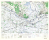
| Renen, Holland. 1:25,000. Map Sheet 5 NE, 2nd Edition, Defence Overprint, 27 March 1945 |
United States. Army Map Service |
1945 |
|
| Research Plot |
Ontario Ministry of Natural Resources |
1900 - 2006 |

|
| Residential Schools Location Project |
Orlandini, Rosa |
2019 |
|
| Resting Area |
Ontario Ministry of Natural Resources |
1998 - 2004 |

|
| Retail Point |
DMTI Spatial Inc. |
2015 - 2023 |

|
| Rheinberg, Germany. 1:25,000. Map Sheet 4405, 3rd Edition, Defence Overprint, 22 January 1945 |
Great Britain. War Office. General Staff. Geographical Section. |
1945 |
|
| Road at 600K |
Ontario Ministry of Natural Resources |
1995 |
|
| Road Junction Point |
DMTI Spatial Inc. |
2015 - 2023 |

|
| Road Network File (RNF) (Intercensal) |
Statistics Canada |
2005 - 2022 |
|
| Road Network File (RNF), 2011 Census |
Statistics Canada |
2011 |

|
| Road Network File (RNF), 2016 Census |
Statistics Canada |
2017 |

|