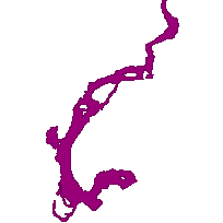
This data set can be used to identify a fish travel corridor, which is a polygon feature that identifies a route used by a fish species for migration.
Information on fish migration routes is important for planning development and reviewing work permits. Any structures placed in the migration route, or work in the area would need to be planned specifically to allow fish migration.
Migration routes are usually parts of streams or rivers, but could include pathways that connect wetlands to lakes or rivers, or pathways within or between lake basins that fish use seasonally as a migration route to carry out a component of their life cycle.
Supplementary tables can be used and are available for download from the additional documentation section. Supplementary look-up table descriptions are available in the data description document, which is available for download from the additional documentation section.
Access this resource on Scholars Geoportal.
Access this resource on Scholars Geoportal.