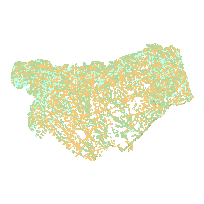
Toronto and Region Conservation Authority (TRCA) data represents various natural features for the TRCA jurisdiction, which encompasses the Etobicoke, Miimico, Humber, Don, Highland, Rouge, Petticoat, Duffins and Carruthers river watersheds, and the Lake Ontario shoreline from Mississauga to Ajax. Data sets include natural cover, flora, fauna, contours, vegetation and Ecological Land Classification (ELC), watershed, water bodies, and more.
Data sets are available for the 2002/03, 2007/08, and 2013/14 reporting years.
Please note that earlier versions are considered archived and not current, these are for reference and historical purposes only.
Access this resource on Scholars Geoportal.
Access this resource on Scholars Geoportal.
