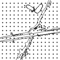
The SWOOP2010 project digital elevation data was acquired with elevation points and significant breaklines to support the orthorectification of the 20 cm resolution imagery. The accuracy requirement for the ortho imagery is 50 cm horizontal. The elevation data collected includes: ground control points; mass points (as dense as 10 m, where applicable) and significant breaklines where the integrity of the imagery would be compromised (bridges/cliffs etc.) upon orthorectification.
Additional processing is required to complete the DEM in order to generate contour mapping.
The data are available for download in two separate .zip files, please download both associated files for full coverage.
Access this resource on Scholars Geoportal.
Access this resource on Scholars Geoportal.
