Revision Note: Please note that this dataset has been revised and is available from the Land Information Ontario (LIO) Warehouse.
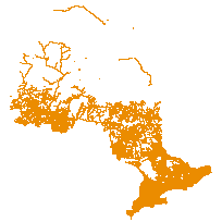
The Ontario Road Network (ORN) is a province-wide geographic database of over 250,000 kilometers of municipal roads, provincial highways, and resource and recreation roads. The ORN is considered the authoritative source of roads data for Ontario.
The ORN Segment with Address is derived from the Linear Referencing System (LRS) data set and provides attributes such as: official street names, alternate street names, route names and numbers, street address ranges, road class, direction and municipality. A segmented dataset is comprised of distinct road segments based on attribution associated with each segment.
A road segment is the linear geometry of the road. Road segments can be consolidated into networks using the MNR Road Network entity. To exist in the Road Segment layer the road must have actually existed as a path supporting conventional four-wheel street legal vehicles.
Supplementary tables can be used and are available for download from the additional documentation section. Supplementary look-up table descriptions are available in the data description document, which is available for download from the additional documentation section.
Access this resource on Scholars Geoportal.
Access this resource on Scholars Geoportal.