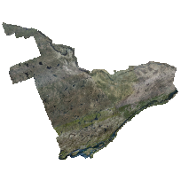
Digital Raster Acquisition Project Eastern Ontario (DRAPE) was acquired in the spring of 2019/2020 under the best conditions possible to achieve cloud free, snow free, ice free, smoke free, and leaf off captures. The orthophotography covers 36,103 sq km, has a pixel resolution of 16cm and is accurate to 45 centimetres on the ground at 95%. The imagery was acquired by an Vexcel UltraCam X and Vexcel UltraCamEagle digital cameras and was later orthorectified using an elevation dataset generated through image correlation.
Compressed GeoTIFFs: These images are JPEG-compressed GeoTIFFs, and are suitable for analysis in many cases. Should you require uncompressed TIFF files, these may be requested for download by contacting geoportal@scholarsportal.info, and providing your name and institution (ex. University of Guelph).
Please note: Due to the size of these tiles (~500 MB each), please request a portion of the data only. This can be done by including a polygon file of the study area, a description of a desired feature/area (ex. UTM campus), or a screenshot in your e-mail.
Access this resource on Scholars Geoportal.
Access this resource on Scholars Geoportal.
