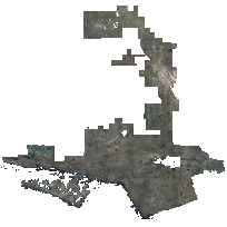
Central Ontario Orthophotography (COOP) was acquired in the spring of 2021 under the best conditions possible to achieve cloud free, snow free, ice free, smoke free and leaf off captures. The orthophotography has a pixel resolution of 20 centimetres and is accurate within 60 centimetres on the ground at 95% confidence. It is provided as 8-bit depth GeoTIFF and compressed GeoTIFF files. The imagery was acquired by an Vexcel UltraCam X and Vexcel UltraCam X Prime digital cameras and was later orthorectified using an elevation dataset generated through image correlation.
Imagery was captured from April 2nd to June 1st, 2021. The project encompassed an area of approximately 49,540 square kilometres covering Central Ontario, including Timmins, Temiskaming Shores, Greater Sudbury, Elliot Lake, North Bay, Lake Nipissing, and Manitoulin Island. This aerial project is part of a five-year plan (2018-2022) to acquire high resolution, leaf-off imagery across the province.
Orthoimagery are available in 1km by 1km coverage tiles. A stereo frame index shapefile will be available in 2022 through Land Information Ontario's GeoHUB.
Compressed GeoTIFFs: These images are JPEG-compressed GeoTIFFs, and are suitable for analysis in many cases. Should you require uncompressed TIFF files, these may be requested for download by contacting geoportal@scholarsportal.info, and providing your name and institution (ex. University of Guelph).
Please note: Due to the size of these tiles (~500 MB each), please request a portion of the data only. This can be done by including a polygon file of the study area, a description of a desired feature/area (ex. UTM campus), or a screenshot in your e-mail.
Access this resource on Scholars Geoportal.
Access this resource on Scholars Geoportal.
