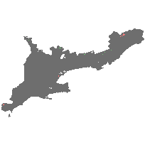
As of March 2010 the Agricultural Resource Inventory (ARI) is available as a single data set covering Southern Ontario. The ARI is a framework of farmsteads, farm fields, fencerows, ditches, roadways, rough land and riparian areas to create a seamless digital landscape - building from the urban, wetlands and woodlots provincial layers.
Through project partnerships with other agencies, all of the county maps have been stitched together to cover Southern Ontario as a single data set. The county data sets have subsequently been replaced by this data set within the Land Information Ontario Warehouse. There are 36 municipalities included in the inventory.
Note: This dataset differs from the ARI - Final dataset (2017), both in terms of coverage area and the way that the data has been classified. The ARI - Final dataset broadly denotes land use, and does not provide information on specific crops or field use.
Access this resource on Scholars Geoportal.
Access this resource on Scholars Geoportal.
