Retirement Note: Please note that these data are replaced by Aggregate Site Authorized - Active and Aggregate Site Authorized - Inactive, and are available through the LIO warehouse.
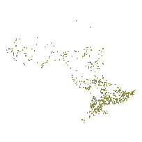
Contains all the Licenced and Permitted Pits and Quarries under the Aggregate Resources Act of Ontario that are regulated by Ministry of Natural Resources. Polygons represent the Licenced or Permitted boundary of the Pit or Quarry. The data in this data set should ONLY include those that reside currently within the ALPS (Aggregate Licencing and Permitting System) application. The data within is 'Authorized' by ALPS. No other data should be entered. If it doesn't have an ALPS ID (Licence or Permit ID), then it does not belong. This data does not include Ministry of Transportation pits. This layer is part of what was known as the OMNR Fundamental Dataset.
Access this resource on Scholars Geoportal.
Access this resource on Scholars Geoportal.
