Index to WWI Trench Maps and Aerial Photographs
Text Search using Place Name or Trench Name:
10,300+ place names compiled from the maps in our collection.
10,500+ trench names derived from the book, "Rat's Alley: Trench Names of the Western Front 1914-1918," courtesy of the author, Dr. Peter Chasseaud.
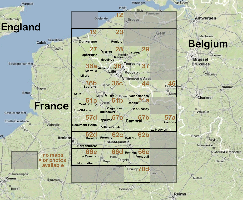
Visual Search using Map Index:
click in any of the grid squares on the index to view our collection of maps & photos for that area. Grey grid squares indicate that no material is available for the area
NOTE: 1:40,000 scale maps were used for planning over large areas and do not usually show individual trenches.