Geospatial Data
| Title Sort descending | Author | Year | Sample |
|---|---|---|---|
| Manitoba Land Initiative - Digital Maps | Manitoba Land Initiative |
Varies by dataset | |
| Mineral Deposit Inventory | Ontario Ministry of Northern Development and Mines | 2013 | 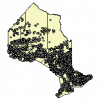
|
| Mineral Deposit Inventory (2010 version) | Ontario Ministry of Northern Development, Mines and Forestry | 2010 - 2013 | 
|
| Miscellaneous Release Data (MRD) Sets | Ontario Geological Survey |
Various | |
| Natural Earth | Many volunteer NACIS members and cartographers around the globe outlined below: https://www.naturalearthdata.com/about/contributors/ | 2009-2024 | |
| Ontario Airborne Geophysical Surveys, Magnetic and Electromagnetic Data, Latchford Area | Ontario Ministry of Northern Development and Mines | 2013 | 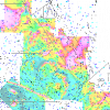
|
| Ontario Drill Hole Database | Ontario Ministry of Northern Development and Mines | 2013 | 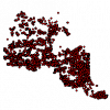
|
| Ontario GeoHub | Ontario Ministry of Natural Resources |
Varies by dataset | |
| Paleozoic Geology of Southern Ontario | Ontario Geological Survey |
2007 | |
| Peatlands of Canada | Natural Resources Canada |
2011 | |
| Physiography - Lines (PHL) | DMTI Spatial Inc. | 2001 - 2014 | 
|
| Physiography - Points (PHP) | DMTI Spatial Inc. | 2001 - 2014 | 
|
| Physiography - Regions (PHR) | DMTI Spatial Inc. | 2001 - 2014 | 
|
| Polar Data Catalogue | Canadian Cyrospheric Information Network (CCIN) |
Varies by dataset | |
| Quaternary Geology of Ontario | Ontario Ministry of Northern Development and Mines | 1950 - 1988 | 
|
| Selected World Mineral Deposits Database | Geological Survey of Canada |
2003 | |
| Slope Instability Studies - Ottawa Area | Ontario Ministry of Natural Resources | 1976 - 1983 | 
|
| Socioeconomic Data and Applications Center (SEDAC) Datasets | NASA Socioeconomic Data and Applications Center (SEDAC) |
Various, 1970 to Present | |
| Soil and Terrain Database for Central Africa (SOTERCAF) | United Nations Food and Agriculture Organization (FAO) and International Soil Reference and Information Centre (ISRIC) |
2006 | |
| Soil and Terrain Database for Southern Africa (SOTERSAF) | United Nations Food and Agriculture Organization (FAO) and International Soil Reference and Information Centre (ISRIC) |
2003 |
