Geospatial Data
| Title Sort descending | Author | Year | Sample |
|---|---|---|---|
| Great Lakes Islands (International) - Grouped Coastal Environments | Ontario Ministry of Natural Resources | 2006 - 2010 | 
|
| Great Lakes Islands (International) - Islands | Ontario Ministry of Natural Resources | 2006 - 2010 | 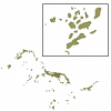
|
| Greenbelt Natural Heritage System - Areas REPLACED | Ontario Ministry of Natural Resources | 2005 - 2015 | 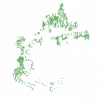
|
| Greenbelt Natural Heritage System - Urban River Connections | Ontario Ministry of Natural Resources | 2005 | 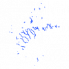
|
| Greenbelt Selected Wildlife Habitat | Ontario Ministry of Natural Resources | 1997 - 1999 | 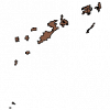
|
| Habitat Planning Range | Ontario Ministry of Natural Resources | 1998 - 2008 | 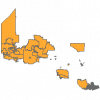
|
| Haliburton County Enhanced Wetland Mapping | Ducks Unlimited Canada | 1998 - 2003 | 
|
| Hamilton Conservation Authority Open Data Hub | Hamilton Conservation Authority | Various | |
| Hamilton Tree Inventory | City of Hamilton, Ontario |
2009, 2016, 2018 | |
| Hamilton Vector Data Set | City of Hamilton, Information Technology Services, GIS Services. |
2003 - 2020 | |
| Historic Bathymetry Maps | Ontario Ministry of Na | 1940-1990 | |
| Hydro Junctions Point | DMTI Spatial Inc. | 2015 - 2023 | 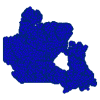
|
| Japan Tsunami Affected Area - March 2011 | East View Cartographic |
2011 | |
| Land and Water Digital Map Series 34: Global Map of Irrigation Areas | United Nations. Food and Agricultural Administration (FAO) |
2013 | |
| Land Information Ontario (LIO) File Geodatabases | Ontario Ministry of Natural Resources | 2011 - 2023 | |
| Littoral Line | DMTI Spatial Inc. | 2015 - 2023 | 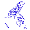
|
| Living Atlas of the World | Esri |
Varies by service | |
| Manitoba Land Initiative - Digital Maps | Manitoba Land Initiative |
Varies by dataset | |
| Mast Producing Area | Ontario Ministry of Natural Resources | 1997 - 2006 | 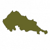
|
| Mineral Lick | Ontario Ministry of Natural Resources | 1997 - 2006 | 
|
