| QuickBird Satellite Imagery - Source Water Protection: Pan sharpened imagery, true colour |
Ontario Ministry of Natural Resources |
2005 - 2007 |

|
| QuickBird Satellite Imagery - Source Water Protection: Panchromatic imagery, greyscale |
Ontario Ministry of Natural Resources |
2005 - 2007 |

|
| QuickBird Satellite Imagery for Far North Communities: Multi-spectral imagery, false colour |
Ontario Ministry of Natural Resources |
2003 - 2008 |
|
| QuickBird Satellite Imagery for Far North Communities: Multi-spectral imagery, true colour |
Ontario Ministry of Natural Resources |
2003 - 2008 |
|
| QuickBird Satellite Imagery for Far North Communities: Panchromatic imagery, greyscale |
Ontario Ministry of Natural Resources |
2003 - 2008 |
|
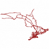
| Railway |
Ontario Ministry of Natural Resources |
1977 - 2012 |
|
| Recreation Point |
Ontario Ministry of Natural Resources |
1997 - 2006 |
|
| Region of Niagara Orthophotography, 2006 |
Ontario Ministry of Natural Resources |
2006 - 2007 |
|
| Region of Peel Orthophotography, 2011 |
Ontario Ministry of Natural Resources |
2011 |
|
| Region of York Orthophotography, 2011 |
Ontario Ministry of Natural Resources |
2011 - 2012 |
|
| Research Plot |
Ontario Ministry of Natural Resources |
1900 - 2006 |

|
| Resting Area |
Ontario Ministry of Natural Resources |
1998 - 2004 |

|
| Road at 600K |
Ontario Ministry of Natural Resources |
1995 |
|
| Road Network Files (RNF), 2001 Census |
Statistics Canada |
2002 |

|
| Road Network Files (RNF), 2006 Census |
Statistics Canada |
2007 |

|
| Road Segment at 1 Million |
Ontario Ministry of Natural Resources |
1983 |

|
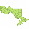
| School Board Boundaries |
Capital Policy & Programs, Ministry of Education |
2016 - 2017 |
|
| School Facility |
Ontario Ministry of Natural Resources |
2005 |
|
| Seed Area |
Ontario Ministry of Natural Resources |
1997 - 2004 |

|
| Seed Zone |
Ontario Ministry of Natural Resources |
1998 |
|