Geospatial Data
| Title Sort descending | Author | Year | Sample |
|---|---|---|---|
| Ontario Airborne Geophysical Surveys, Magnetic and Electromagnetic Data, Latchford Area | Ontario Ministry of Northern Development and Mines | 2013 | 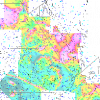
|
| Ontario Base Map (OBM) Digital Data | Ontario Ministry of Natural Resources | 1977 - 2008 | 
|
| Ontario Classified Point Cloud (Lidar-derived) | Ontario Ministry of Natural Resources and Forestry - Provincial Mapping Unit | 2015 - 2024 | |
| Ontario Drill Hole Database | Ontario Ministry of Northern Development and Mines | 2013 | 
|
| Ontario GeoHub | Ontario Ministry of Natural Resources |
Varies by dataset | |
| Ontario Hydro Network (OHN) - Hydrographic | Ontario Ministry of Natural Resources | 2010 | 
|
| Ontario Hydro Network (OHN) - Shoreline | Ontario Ministry of Natural Resources | 2010 - 2012 | 
|
| Ontario Hydro Network (OHN) - Waterbodies | Ontario Ministry of Natural Resources | 2012 | 
|
| Ontario Hydro Network (OHN) - Watercourse | Ontario Ministry of Natural Resources | 2010 - 2011 | 
|
| Ontario In-filled Climate Data | Ontario Ministry of Natural Resources | 1950 - 2005 | 
|
| Ontario Integrated Hydrology Data Package | Ontario Ministry of Natural Resources | 2012 | 
|
| Ontario Integrated Hydrology Data: Enhanced Watercourse | Ontario Ministry of Natural Resources | 2012 | 
|
| Ontario Land Cover Compilation v2.0 | Ontario Ministry of Natural Resources and Forestry | Various | |
| Ontario Mining Division Boundaries | Ontario Ministry of Northern Development, Mines and Forestry | 2000 | 
|
| Ontario Parcel Boundaries | Teranet Inc. |
2009 - 2026 | |
| Ontario Public Service (OPS) Region | Ontario Ministry of Natural Resources | 2008 | 
|
| Ontario Radar Digital Surface Model (FL) | Ontario Ministry of Natural Resources | 2010 - 2012 | |
| Ontario Railway Network (ORWN) | Ontario Ministry of Natural Resources | 2012 - 2013 | 
|
| Ontario Road Network Road Net Element (ORN) | Ontario Ministry of Natural Resources | 2001 - 2012 | 
|
| Ontario Road Network Segment With Address (ORN) | Ontario Ministry of Natural Resources | 2010 - 2012 | 
|