Year
1944
Abstract
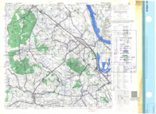
This is a 1:25,000 scale map of the region of Xanten, Germany. It is the third edition of this map, published in December 1944 by the Geographical Section, General Staff (GSGS) of the War Office of Great Britain. The defence overprint was traced by the Royal Canadian Engineers.
This overprint utilizes the Nord de Guerre Zone Grid.
Production information for the base map is 17/DEC44/515RE/785/776. Production information for the overprint is 210/4/45/3RCE/5547.
URL
Access this resource on Scholars Geoportal.
Scholars Geoportal URL
Access this resource on Scholars Geoportal.