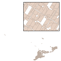
This data set is a polygon feature that can be used to identify the location of licensed agricultural tile drainage areas.
Licensed agricultural tile drainage contractors create plans for numerous agricultural tile drainage systems and install thousands of feet of agricultural drainage tile each year. As a requirement of their license, each contractor must report to the Ontario Ministry of Agriculture, Food, and Rural Affairs (OMAFRA) the location of the area where they installed drainage tile.
Please note that this data was created using the sketches provided by contractors in their tile drainage reports. The sketches are rough estimates of the real world locations of these features. Please use caution when interpreting data and results.
Supplementary tables can be used and are available for download from the additional documentation section.
Access this resource on Scholars Geoportal.
Access this resource on Scholars Geoportal.
