Year
2016
Abstract
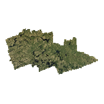
The Southwestern Ontario Orthophotography Project (SWOOP) image data consists of Fugro acquired digital imagery with sensor Leica geosystems ADS100 collected between April 12th and May 23rd 2015.
SWOOP 2015 Algonquin encompasses the region of Algonquin Provincial Park.
Imagery acquisition was performed at 2,377 m AMT (above mean terrain) to produce a 20cm GSD RGBNiR orthorectified imagery.
URL
Access this resource on Scholars Geoportal.
SGP_id
1692149231
Scholars Geoportal URL
Access this resource on Scholars Geoportal.