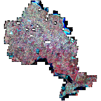
This data set consists of SPOT 4/5 imagery, which was acquired and orthorectified for the entire country by Natural Resources Canada (NRCAN) within a National SPOT orthoimage project between May 2005 and October 2010. The province of Ontario was a partner in this project.
The original imagery was acquired and processed to have a ground sample distance (GSD or pixel spacing) of 10 metres for a panchromatic band and 20 metres for three multispectral bands. MNR has pan-sharpened and enhanced the images covering Ontario, to form a set of 10 metre multispectral (infra-red, red and green) images. This set of images is available as geo-referenced TIFF and/or JPEG2000 files.
Each band has a radiometry of 8 bits (values between 0 and 255). The multispectral image provides four bands. The minimum cloud-free (2% maximum) coverage required for an image (selected zone) is 40 km x 40 km, panchromatic and multispectral taken simultaneously.
Spatial data is expressed according to Universal Transverse Mercator projection, in reference to the North American Datum 1983 - Canadian Spatial Reference System (NAD83CSRS).
Note that these are individual, overlapping images and do not form a mosaic. A subset of these images covering the Far North of Ontario have been processed into a mosaic, and can be found at: https://www.appliometadata.lrc.gov.on.ca/geonetwork/?uuid=bcb6a90d-4547-43e4-9de1-2c8a7e76901d
Approximate image sizes: JP2 format 30 MB, TIFF format 175 MB. Complete project size: JP2 format 12 GB, TIFF format 68.5 GB
Access this resource on Scholars Geoportal.
Access this resource on Scholars Geoportal.