Year
1944
Abstract
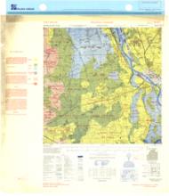
This is a 1:25,000 scale map (geological overprint) of the region of Deventer, Eastern Holland. It is the first edition of this map, published in 1944 by the Army Map Service of the United States Armed Forces.
This overprint utilizes the Nord de Guerre Zone Grid (Blue).
Production information for the map is 1/NOV44/15MRS/444/598A.
URL
Access this resource on Scholars Geoportal.
Scholars Geoportal URL
Access this resource on Scholars Geoportal.