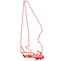
This shapefile represents the boundaries developed for use when aggregating and reporting cases during the COVID-19 pandemic. Boundaries are a mutually exclusive and exhaustive classification of the land area, meaning that they do not overlap with one another (mutually exclusive) and cover all land area in Canada (exhaustive).
Data was built by Prof. Jack Lucas the the University of Calgary, using the Federal data shapefiles, as well as files from the Provinces of British Columbia, Saskatchewan, and Nova Scotia. In some cases, existing regional health areas were used; in others, areas were developed specificially for COVID-19 reporting. Please see additional documentation in Dataverse for more information: https://dataverse.scholarsportal.info/dataset.xhtml?persistentId=doi:10.5683
Access this resource on Scholars Geoportal.
Access this resource on Scholars Geoportal.
