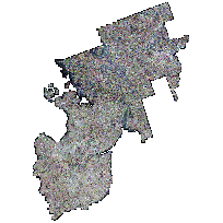
The County of Simcoe, Muskoka and Dufferin Orthophotography Project dataset consists of multiple remotely sensed data products including 30 cm resolution photos that were derived from digital aerial photography collected in April 2008 by First Base Solutions.
These orthophotography encompass the following municipal tiers: The District of Muskoka (Town of Bracebridege, Hunstville, Gravenhurst, Township of Georgian Bay, Township of Muskoka Lakes and Township of Lake of Bays), The County of Dufferin, The Lake Simcoe Region Conservation Authority, County of Simcoe, The City of Barrie, The City of Orillia in the Province of Ontario.
The Province of Ontario is only managing and making available a resampled 30cm version of this data.
Resulting products include:
- 30 cm true colour 1KM X 1KM geotiff tiles
- Digital GPS flight diagram
- 1 KM tile index shape file
- Data Capture flight plan
- 30 cm true colour 1KM X 1KM MrSID tiles
- and MrSID Compressed mosaic orthos
Access this resource on Scholars Geoportal.
Access this resource on Scholars Geoportal.
