Map Scale
The scale of a WWI military map is usually conveyed by a representative fraction, graphic line or both.
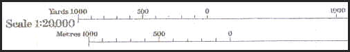
The three most common scales used were 1:40,000, 1:20,000 and 1:10,000.
All three scales of maps were printed on the same size sheets measuring approximately 50 cm wide by 80 cm long from neatline to neatline. The relative difference between the three scales in coverage area is indicated by the shaded rectangles in the diagrams below.
1:40,000
This scale was used primarily by officers for planning. Trenches are not usually present on these maps. Base map information like roads, canals, contour lines and wooded areas were printed in colour. These maps depict a real world area of 20 km running North to South and 32 km running East to West.

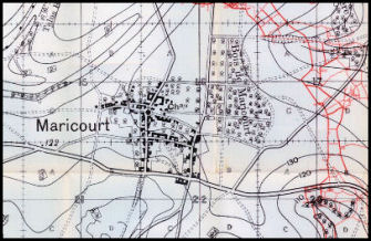
1:40,000 scale map sheet number 62c
Maricourt on sheet 62c at a scale of 1:40,000
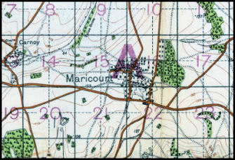
1:20,000
This scale was primarily used by the artillery. Trenches and overprint information are present. All base map information is usually monochrome. These maps depict a real world area of 10 km running North to South and 16 km running East to West.
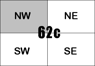
Coverage of 1:20,000 scale sheet 62cNW
in relation to 1:40,000 scale sheet 62c.
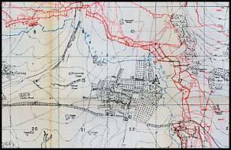
Maricourt on sheet 62cNW at a scale of 1:20,000
1:10,000
This scale was used primarily for trench raids and battle plans at the small unit level. All base map information is usually monochrome. These maps depict a real world area of 5 km running North to South and 8 km running East to West.
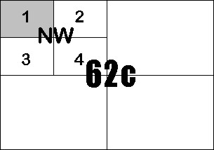
Coverage of 1:10,000 scale sheet 62cNW1
in relation to 1:40,000 scale sheet 62c
Maricourt on sheet 62cNW1 at a scale of 1:10,000