Provenance
The following information about the acquisition of the Robert Clifford Rare Map Collection--purchased as part of the Lord Cholmondeley Collection--is taken from an article entitled, "The McMaster University Rare Maps Collection," written by Dorothy McLennan and Kate Donkin (McMaster University Library's 1st Map Curator), in the McMaster University Library Research News. volume 1, number 4, April 1970.
"The library recently came into possession of a very interesting collection of about 400 maps, predominantly eighteenth century, which were aquired by William Ready in England, when the estate of Lord Cholmondeley was being sold. The subject matter of the Cholmondeley maps is quite varied, Although mainly restricted to the "Old World" the majority are maps of Britain and of the states which now form Germany and Austria. There are also a number of maps of France, the Iberian peninsula, the Low Countries, and other parts of Europe, with a few of Russia and the Crimea.
There are three maps of the world, and a few parts of the East, such as India (1786, 1793), Jerusalem (19th century), and Egypt (1801-2). The maps of England are especially well represented, with a good selection of almost all the county maps surveyed and published in the 1760's as well as detailed town plans of London (1766, 1799, 1804 etc.) and Bath (1793). A large number of the European maps seem to have been made or purchased primarily to serve the needs of the military. Many are plans of the defences of cities throughout Europe, such as Metz, Luxemburg, Nancy; and maps such as Plan de la bataille de Hochkirche (1759) and Reconnaissance militaire du Hundsruck (1797-8). Several are drawn by hand, and seem to belong to the first decade or so of the 18th century. These ones are especially detailed, of course, and mark all the fortifications, troops, camps, etc. The language of these maps is French. One unusual map is a child's game, to be played with dice and counters, the object being to make a tour of England and Wales, combining the learning of useful geographical facts with the fun of a game. It was published in London in 1780, and is called Bowle's British geographical amusement. The Cholmondeley maps tend to fall into two or three easily recognised groups -- the maps of Britain; the military maps of Europe; and a few maps obviously added to the collection later during the 19th century.
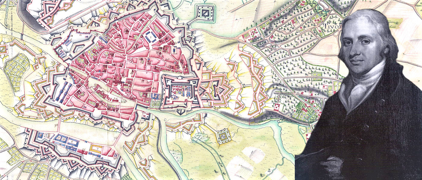
It may be of interest to try to give some information about the 18th century owner of the Cholmondeley maps. It is not known whether Lord Cholmondeley had any real interest in rare maps, or whether the maps were merely part of his inheritance which came to light only when his estate was broken up. There is, however, one name connected with some of the maps. Certain maps have a label pasted on the back, bearing the name of the Hon. Robert Clifford, with the motto Semper paratus and two wyverns; others have a similar label with the initials R.C. and a design of oak leaves. The coat of arms of the barons Clifford of Chudleigh (Devon, England) includes a wyvern and the motto Semper paratus. The only Hon. Robert Clifford I have been able to trace is a younger son of Hugh, 5th baron Clifford of Chudleigh, born in 1767, died unmarried in 1817 (Debrett, and Burke's Peerage). The maps which bear the labels are some of the earliest in the collection, dating, as I have said above, to the first decade of the 18th century, and the language used on these is French. Naturally this does not rule out the possibility of the Hon. Robert Clifford owning them at a later date, especially when we consider the likelihood of his being a soldier himself. The careers open to the younger sons of the nobility at that time were almost completely restricted to the Church and the Army, and it is remarkable how many of the maps do seem to have been made for military purposes. That he may have been something of a scholar as well is suggested by an entry in the British Museum Catalogue, where the Hon. Robert Clifford is given as translator of Barruel's Memoirs illustrating the history of Jacobinism, 1797; and of Buce's Parallel of Rome de l'Isle's and the Abbe Hauy's theories of crystallography, 1804; and as author of Application of Barruel's Memoirs... to the secret societies of Ireland and Great Britain, 1798. No dates of birth or death are given, but the dates of publication fit in quite reasonably to the life of the Hon. Robert Clifford mentioned in Burke's Peerage.
The physical condition of the maps is very good. It would seem that they were bought as sheets of about a foot square in most cases, and that the sheets were then mounted on linen so that the paper was protected, but the map could still be folded. This means that no restoration work has been necessary; the maps are still as easy to read as they originally were. With normally careful handling they are quite usable. Maps such as these are obviously of scholarly interest. They show the boundaries of states throughout the 18th century, and illustrate the course of the battles and wars which make up the history of Europe. The surveyors who made these maps were skilled at their trade. Their standards were far removed from those of earlier map-makers who had been content to guess at the size and shape of the world, and who filled the empty spaces on their maps with legends such as "Here be dragons". The surveyors of the 18th century worked with scientifically correct instruments, and although it is true that many parts of the world, such as the southern parts of Africa, the northern areas of America, and most of Australia were still uncharted, those parts which were mapped, named, and well known tally very well with modern maps of the same areas.
The maps complement the Rare Book Room's collection of works of travel printed in the 18th century. It would no doubt be very interesting to read the written accounts of places and people of various parts of the world in conjunction with the contemporary maps of the same areas."