Year
Select years between 1999 and 2014
Projection
NAD 1983 UTM Zone 17N
Datum
NAD83
Abstract
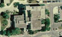
Digital Orthophotos are available for the following years:
- 1999
- Built-up urban areas of the new City of Hamilton (formerly Regional Municipality of Hamilton-Wentworth)
- Rural areas are excluded - see index
- The photographs were taken over several days in May 1999
- 2002
- Taken in the spring of 2002 cover the City of Hamilton
- See index
- 2005
- Digital colour orthophotos covering the City of Hamilton
- Coverage shot in spring of 2005
- Two different resolutions available: 1 m resolution image is a single mosaic of the whole City; 20 cm resolution is three separate mosaics covering North, Central and South portions of the City
- 2007
- 1m resolution imagery is provided as a single mosaic of the whole city, whereas the 15cm imagery is provided in 1km tiles
- An index showing the locations and file numbers of the individual tiles is available in the Library (H:\AirPhotos\Hamilton\2007_Orthophotos\2007 Index.pdf)
- 2010
- Digital colour orthophotos for the city of Hamilton at a 15cm resolution
- 2014
- Digital colour orthophotos for the city of Hamilton at a 15cm resolution
Request data
To request this data, please fill out the Data Use Agreement.File Location
This data is available through the Library's GIS Services, contact libgis@mcmaster.ca.
Scholars Geoportal URL
N/A
