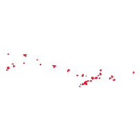
This dataset contains the boundaries of all 3,302 Census Tracts (CT) in Canada for the 1981 Census.
Census tracts are small, relatively stable geographic areas that usually have a population of 2,500 to 8,000. They are located in census metropolitan areas and in census agglomerations with an urban core population of 50,000 or more from the previous census.
These files were digitized at the University of Toronto Map & Data Library to improve accuracy over the original 1981 CARTLIB files from Statistics Canada. They were digitized by tracing 2011 census tract polygons where boundaries have not changed, and using georeferenced Statistics Canada 1981 census tract maps where boundaries have changed. All maps were georeferenced using first order polynomial transformation. The digitized dataset contains CMAUID, CTNAME and CTUID fields containing the identifiers for each census metropolitan area and each census tract. These fields can be used to join associated tabular data.
The original CARTLIB data files, digitized Shapefiles for each CMA, and other supporting files and documentation, are available as additional downloads from Scholars GeoPortal.Access this resource on Scholars Geoportal.
Access this resource on Scholars Geoportal.
