Rare Maps held in Research Collections
Accession #107498
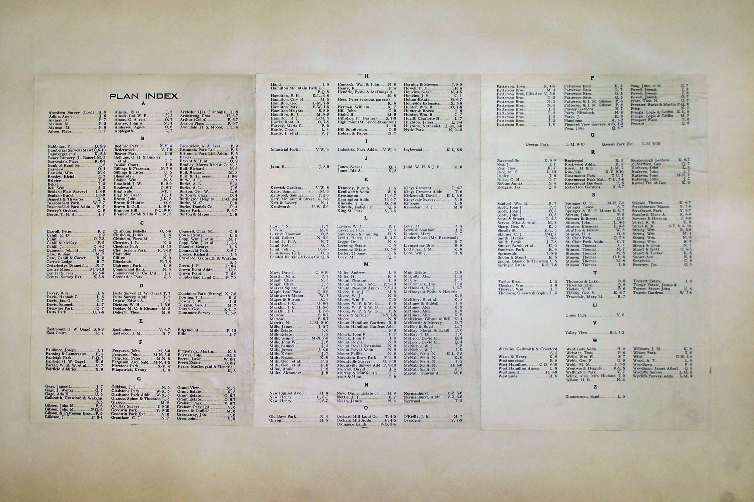
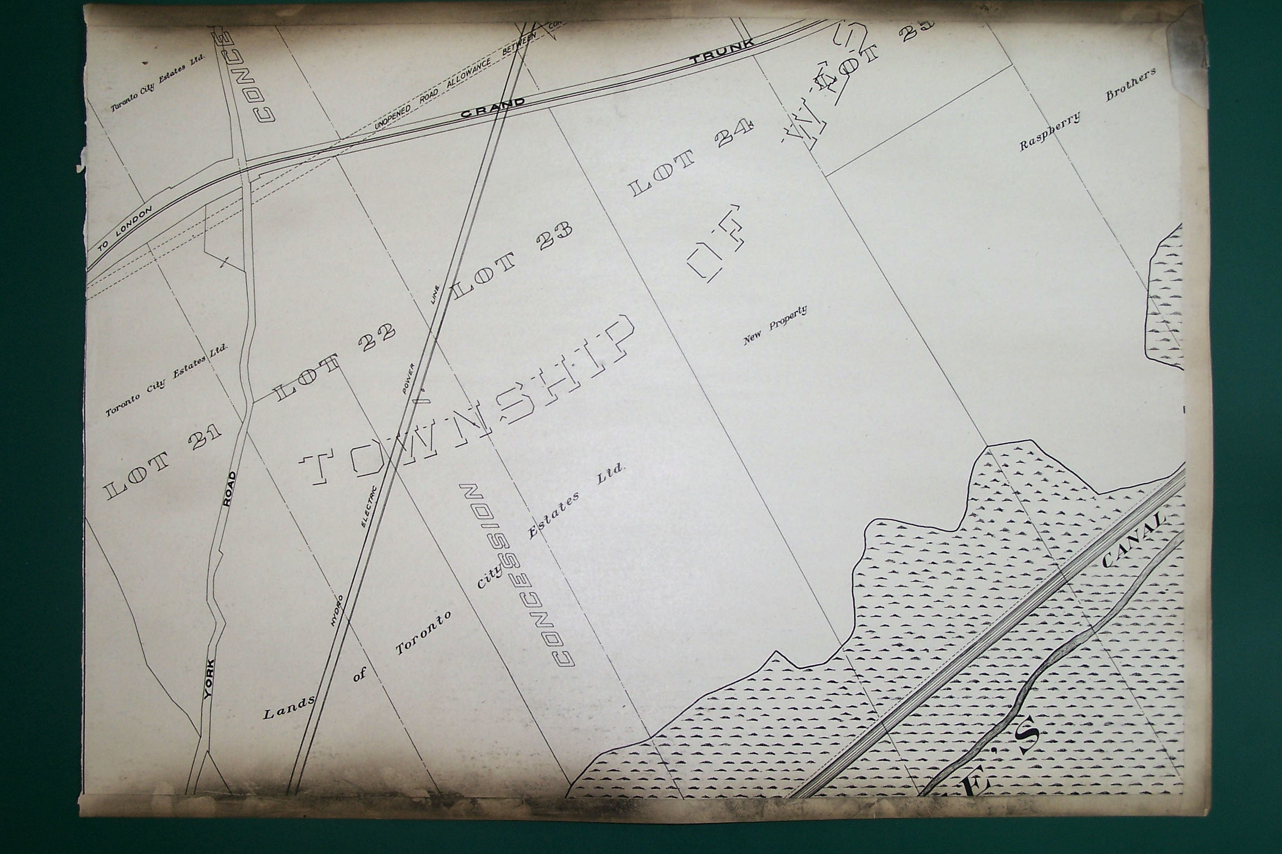
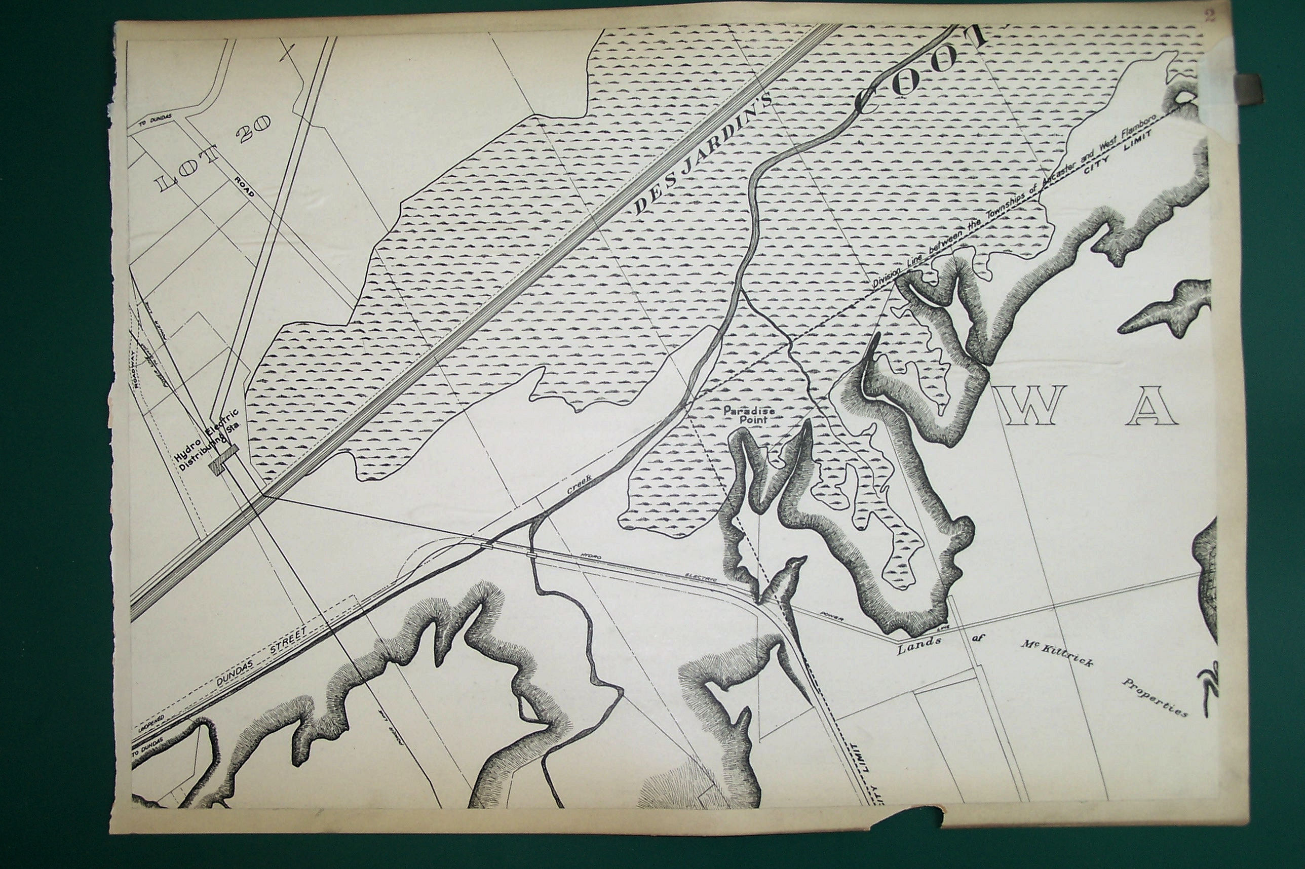
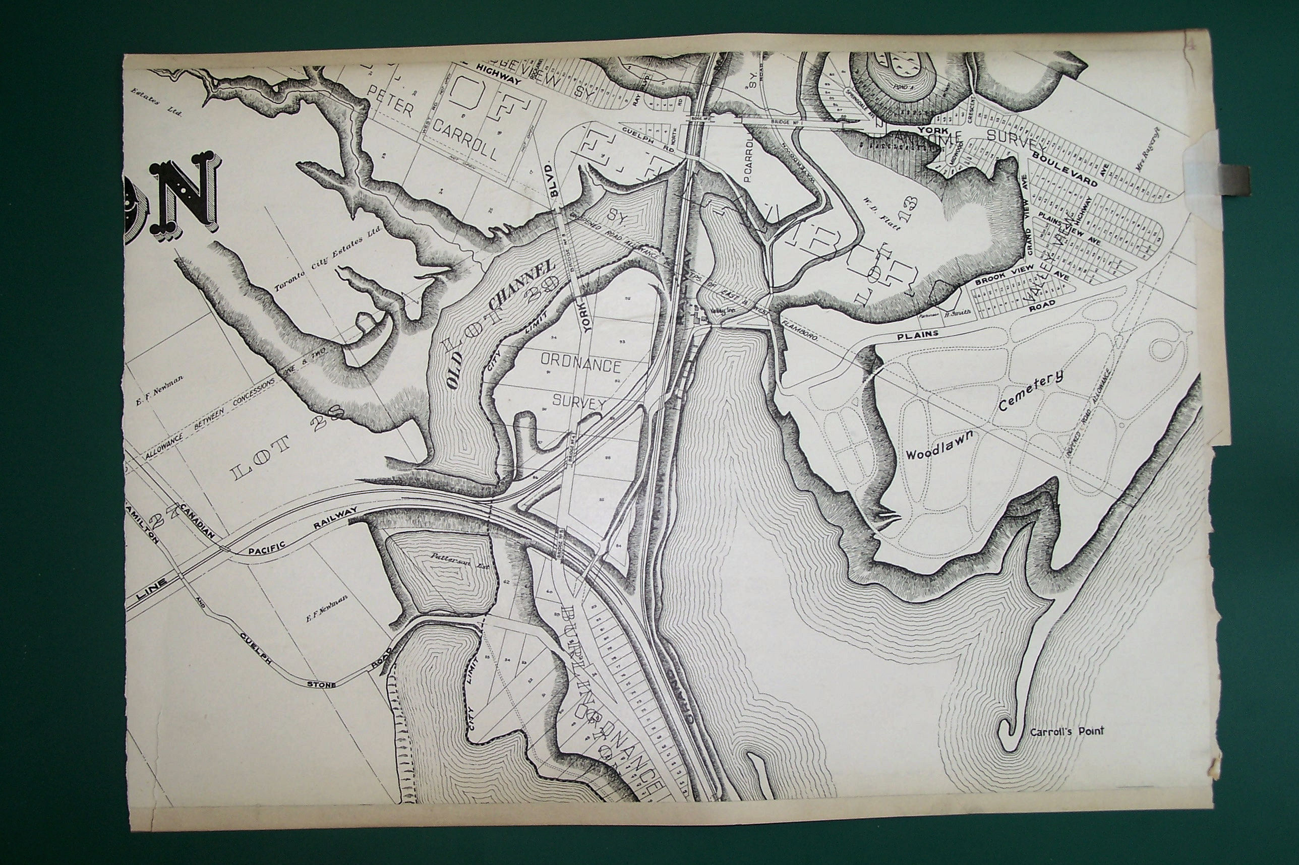
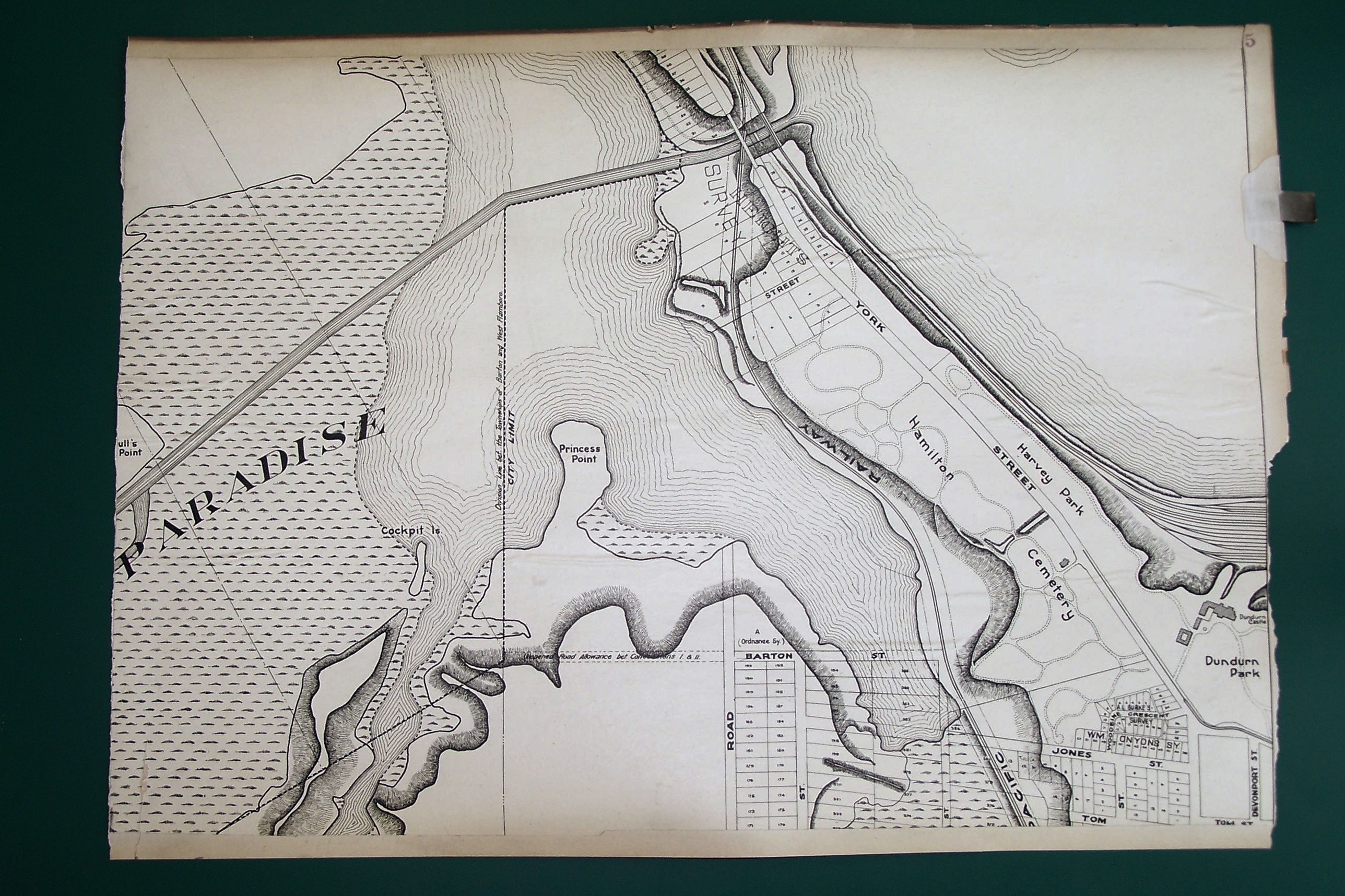
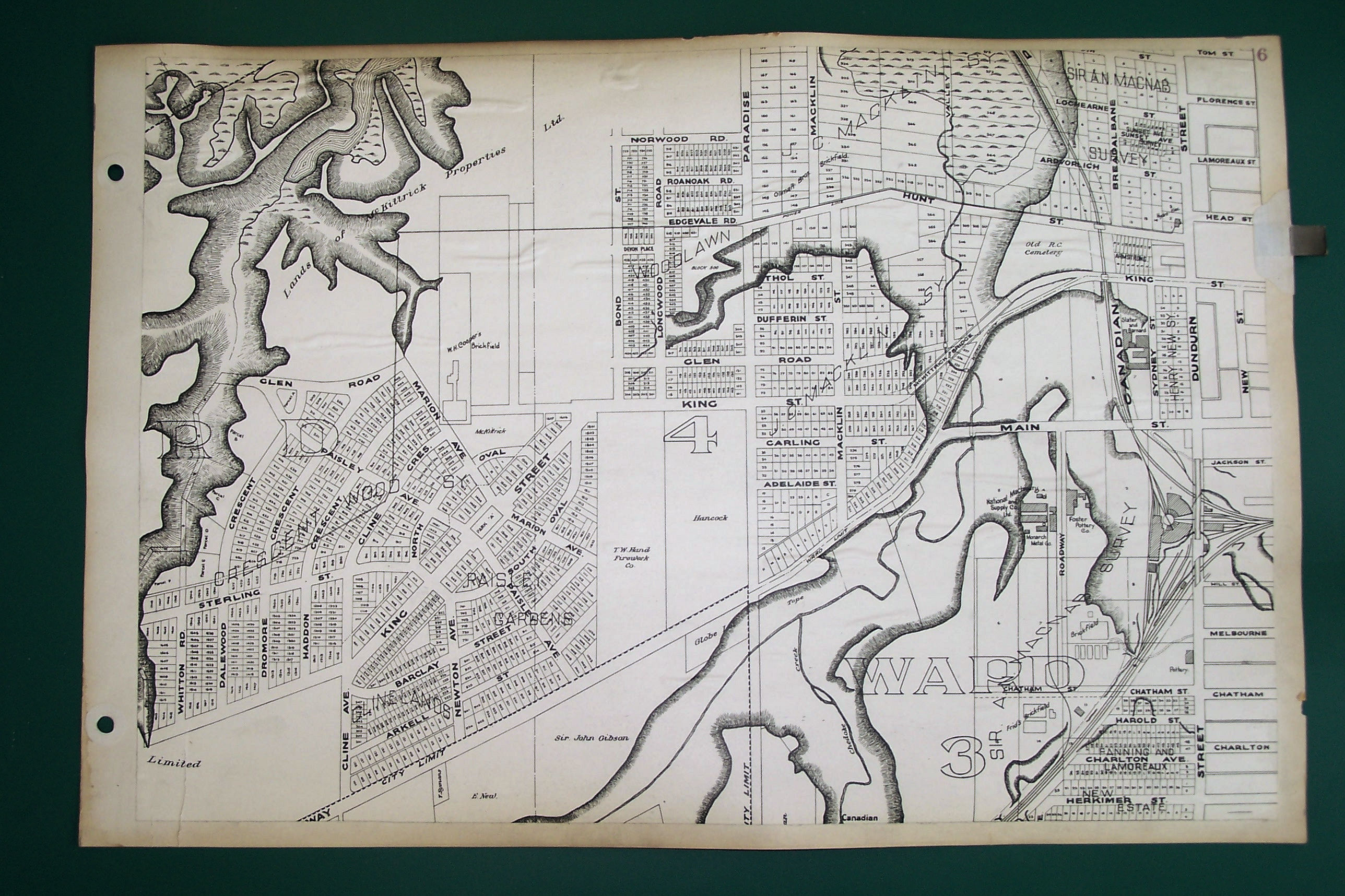
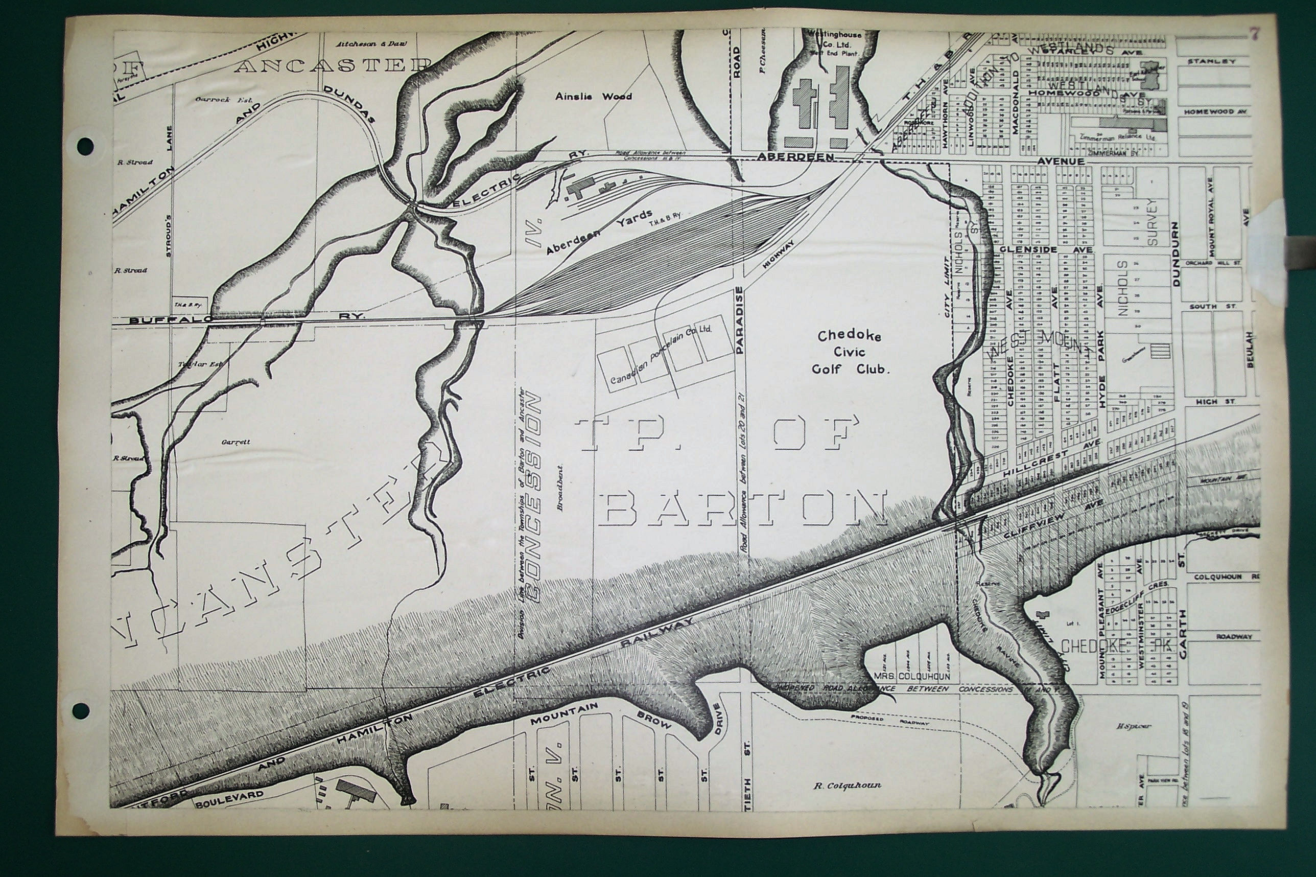
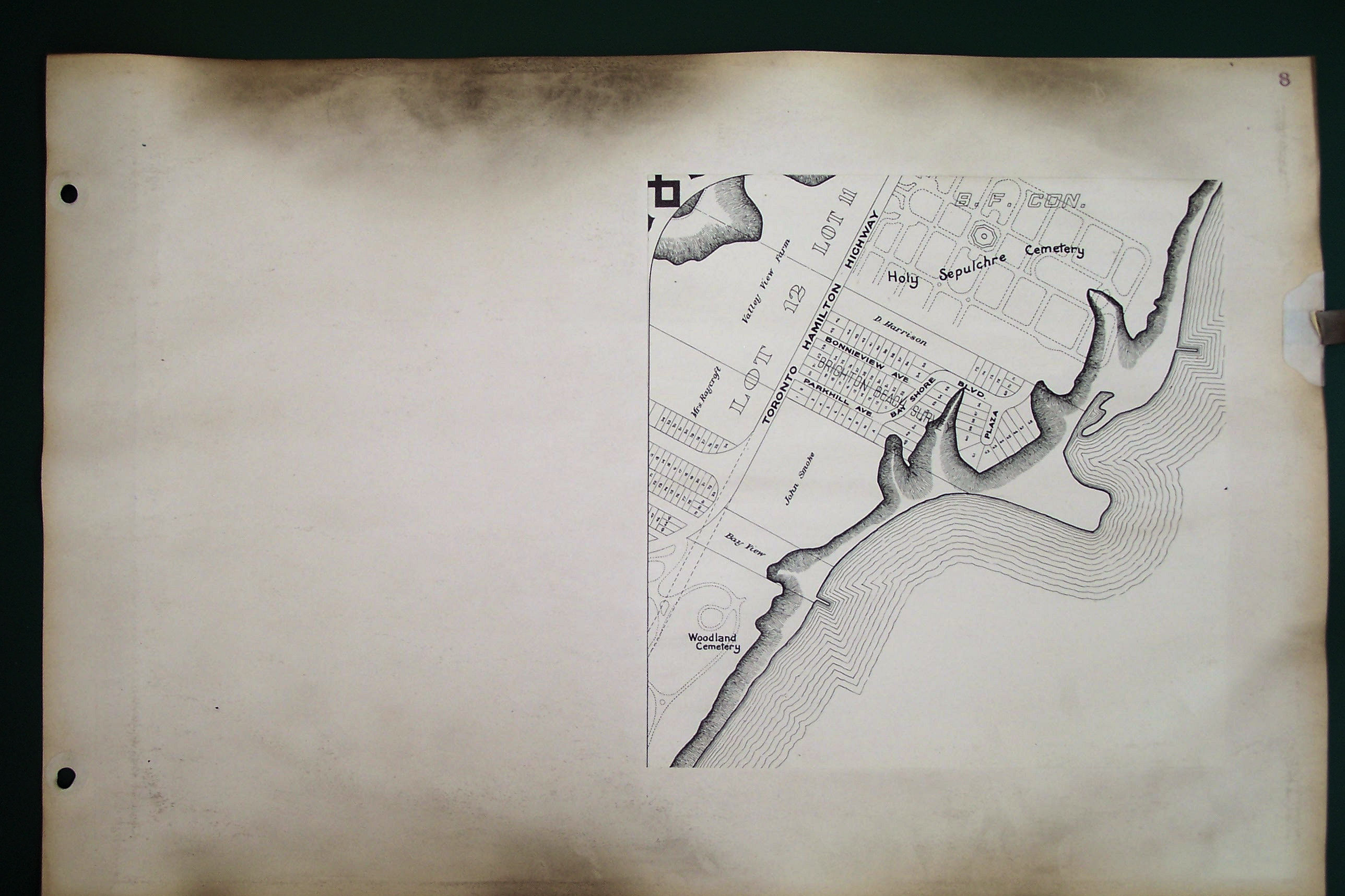
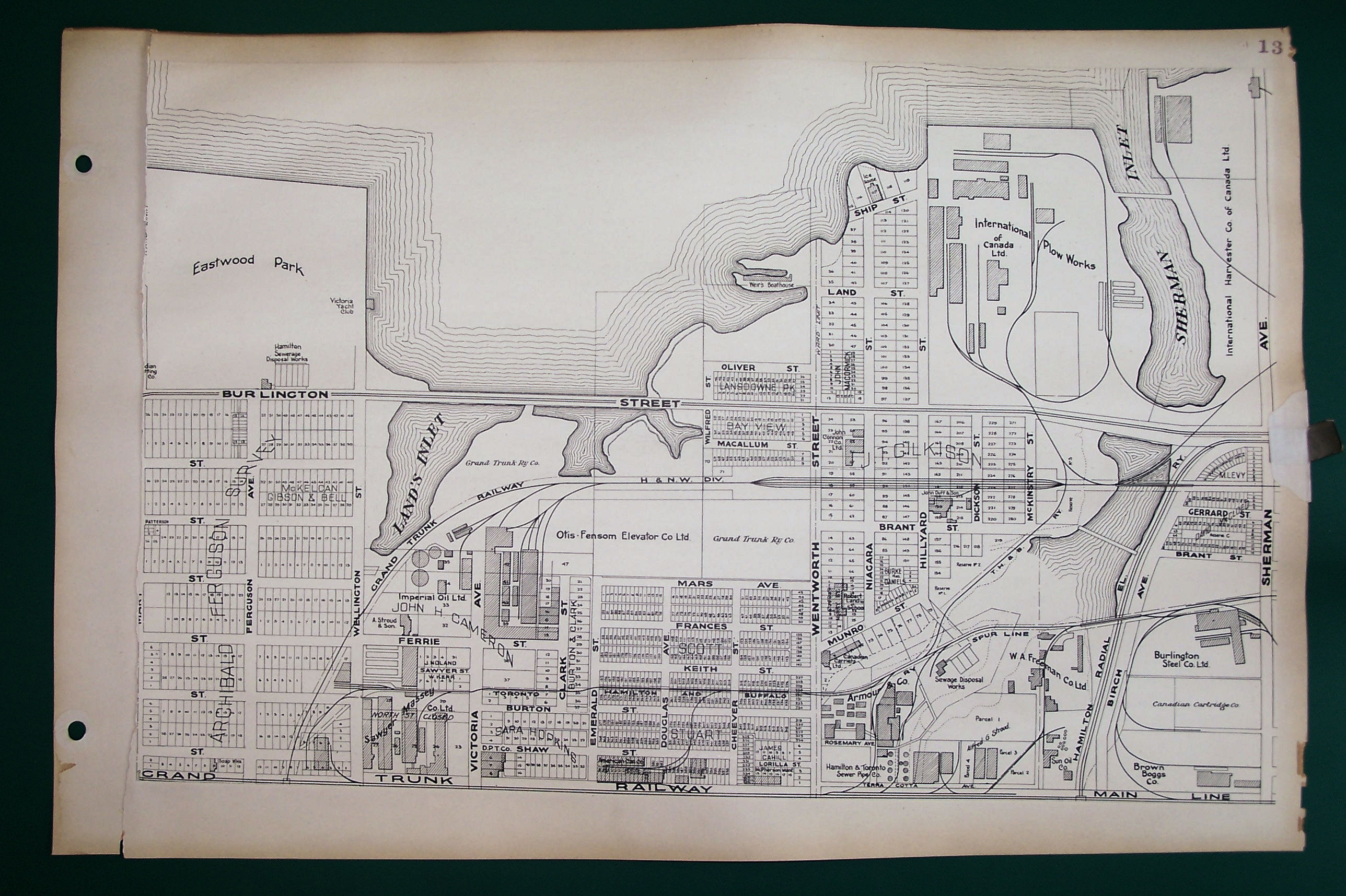
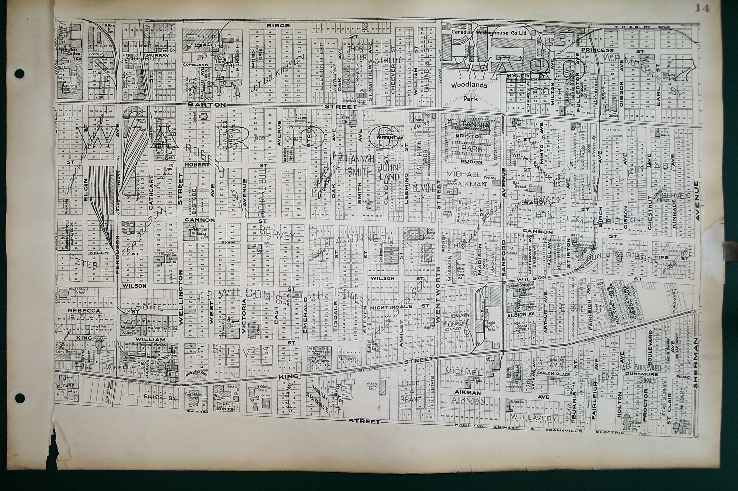
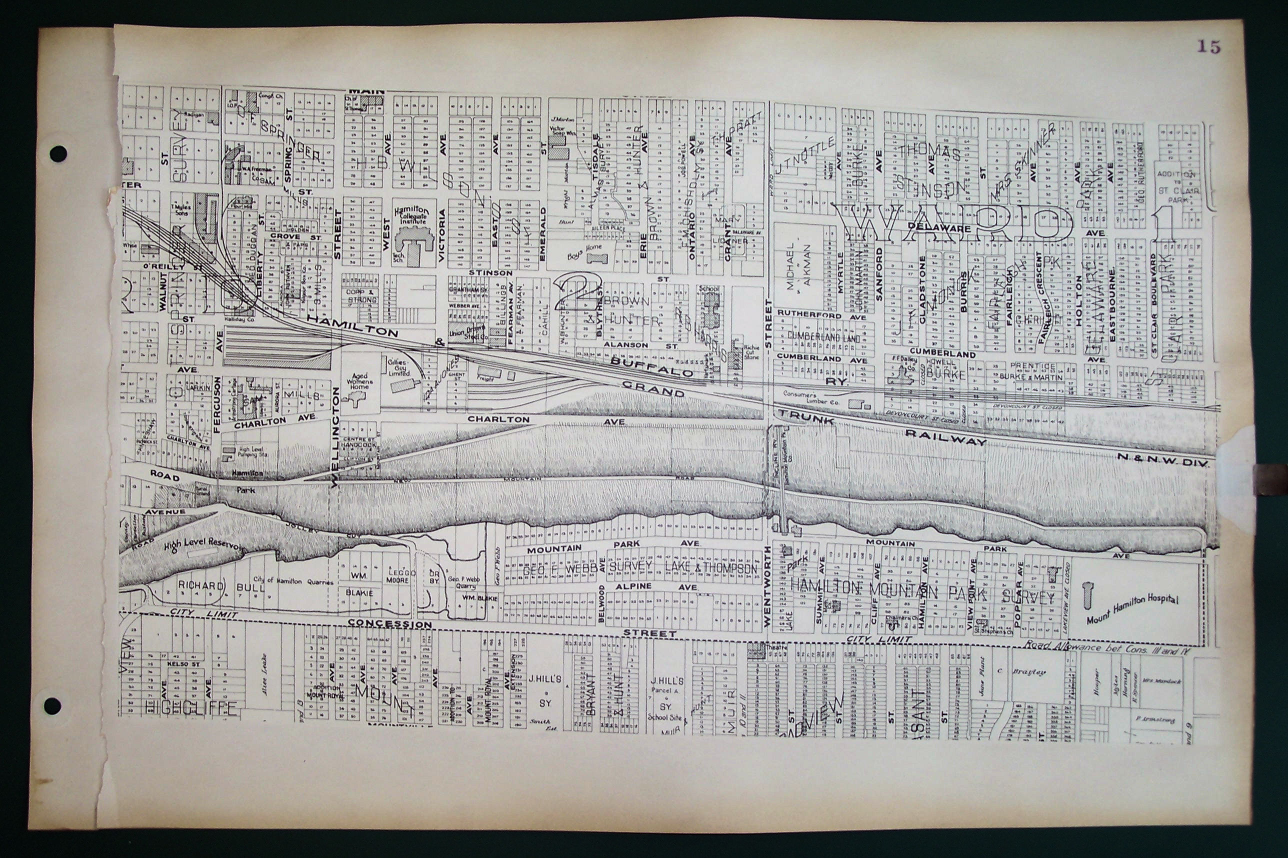
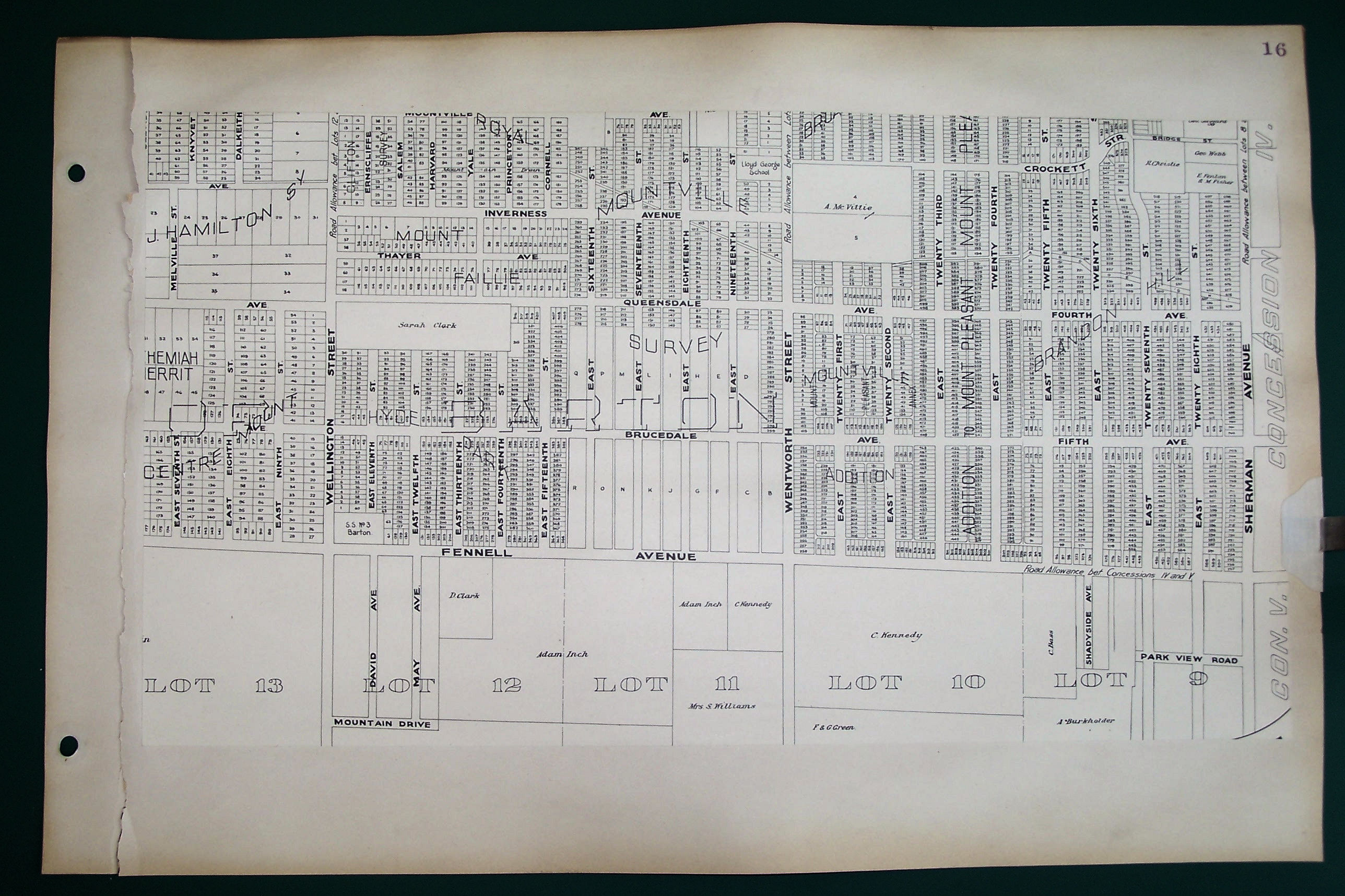
Tyrrell's Atlas of the City of Hamilton Canada (1924)
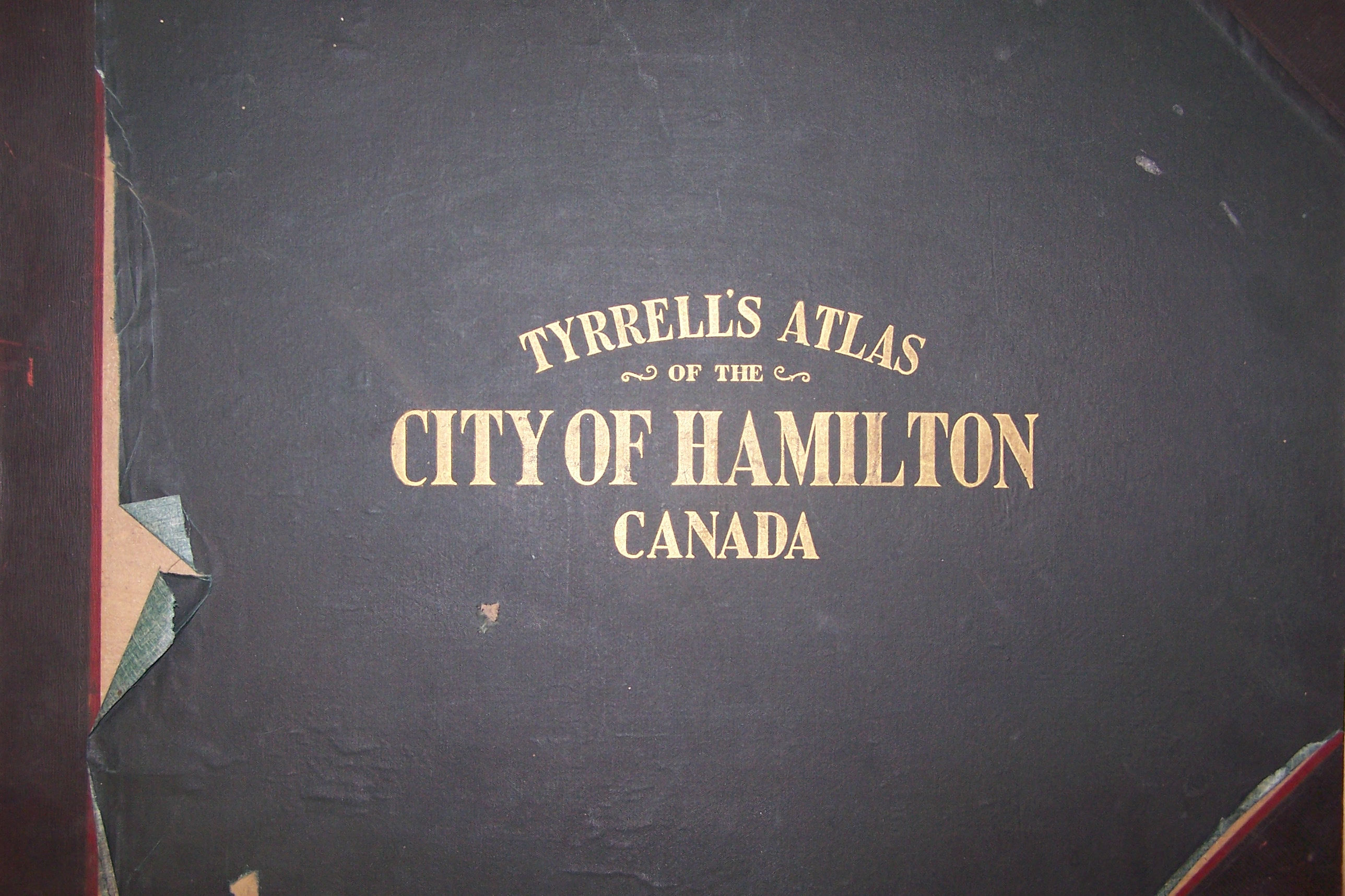
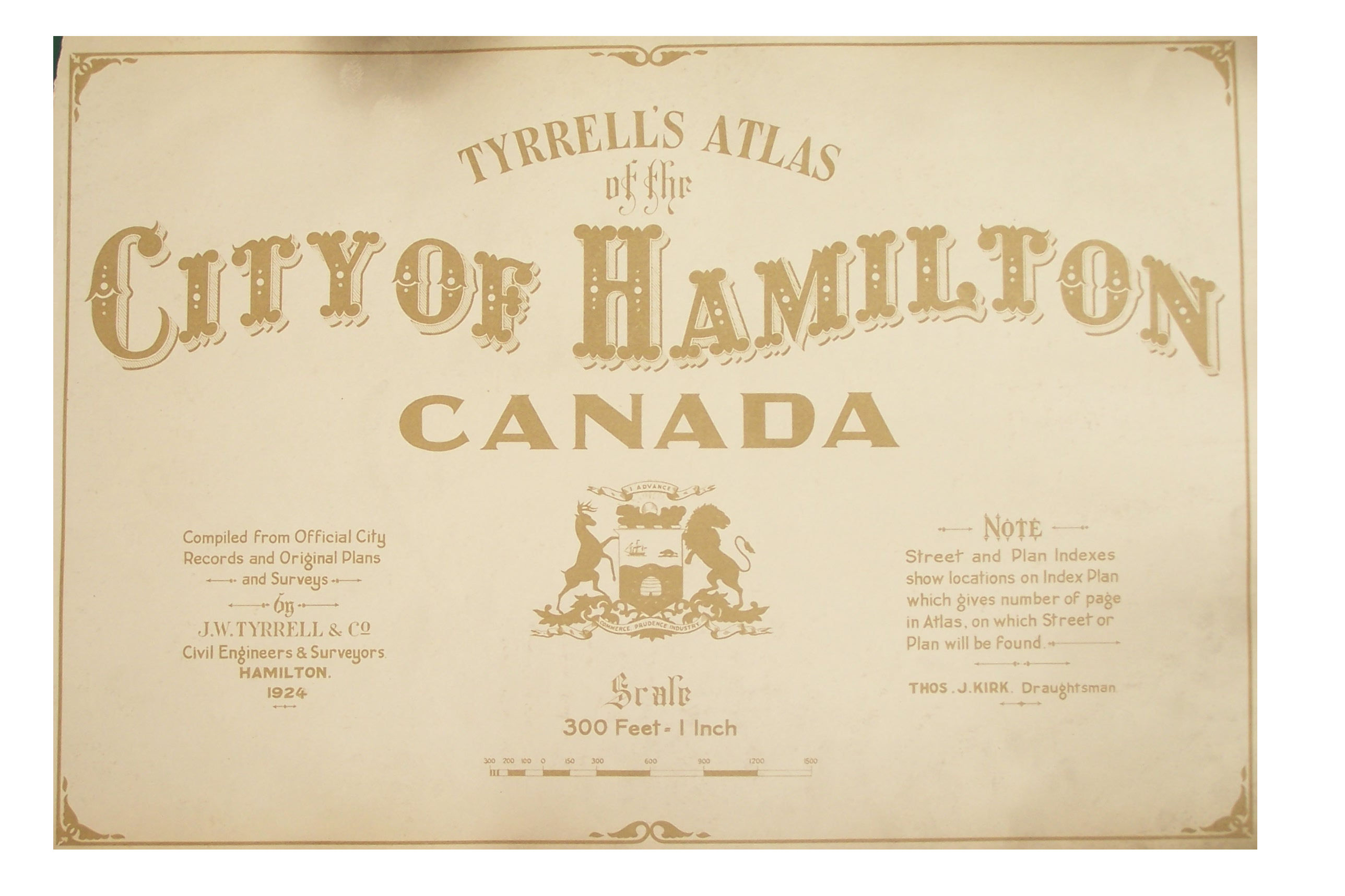
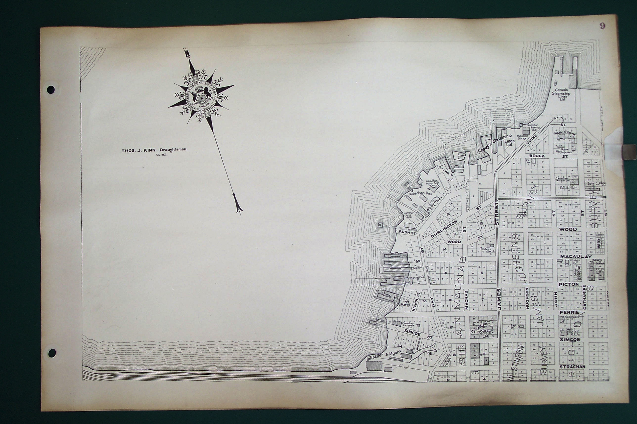
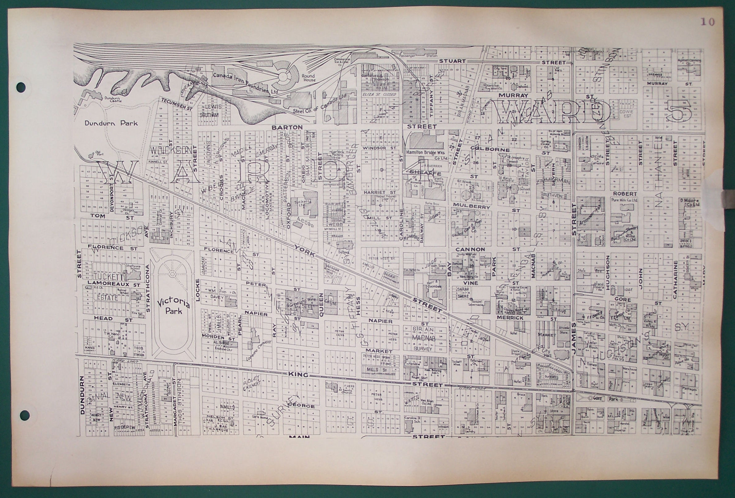
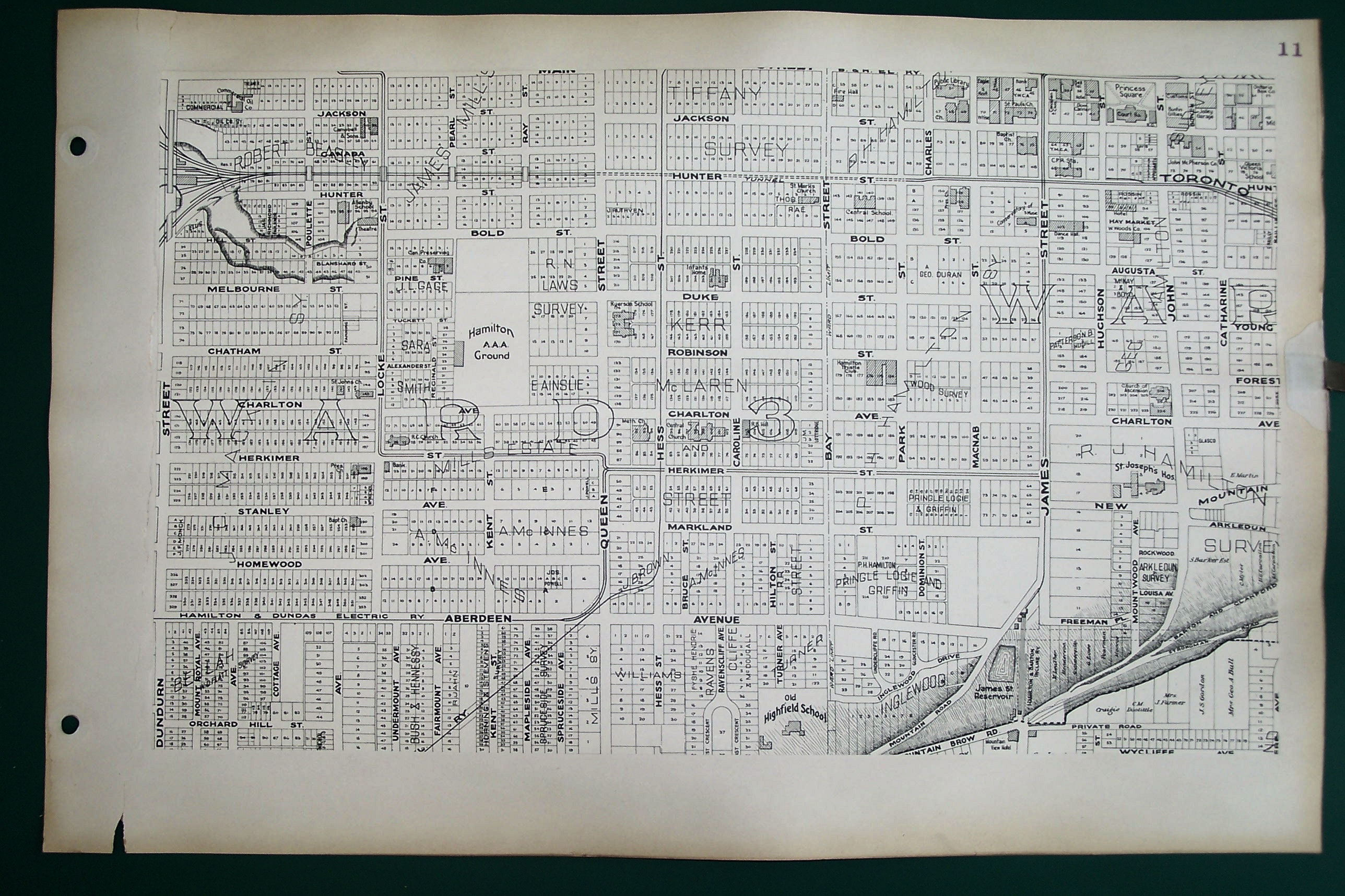
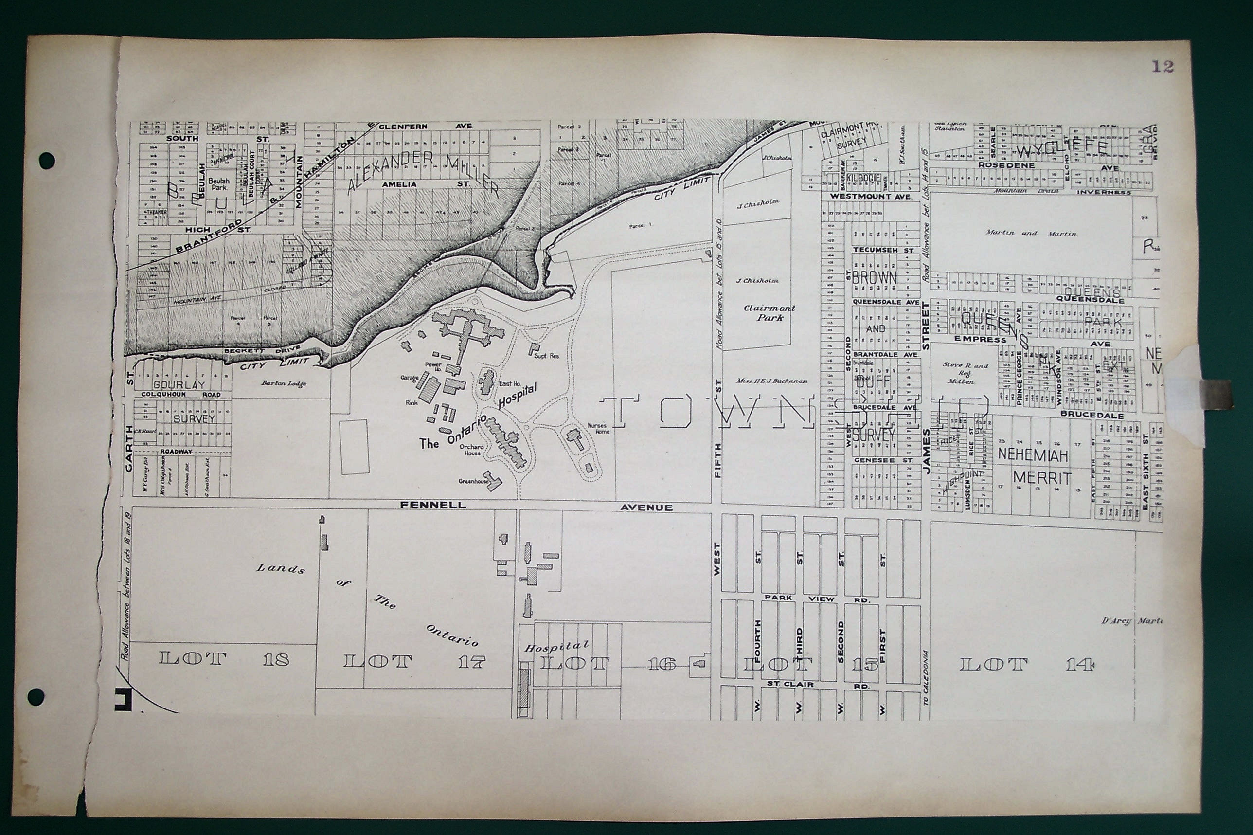
TYRRELLS ATLAS / of the / CITY OF HAMILTON / CANADA // Compiled from Official City / Records and Original Plans / and Surveys / by / J.W. TYRRELL & CO. / Civil Engineers & Surveyors / HAMILTON. / 1924 // THOS. J. KIRK, Draughtsman
- James Williams Tyrrell (1863-1945), published 1924
- In: J.W. Tyrrell & Co. Tyrrells atlas of the City of Hamilton, Canada. Hamilton, Ont. : J. W. Tyrrell & Co. Civil Engineers and Surveyors, 1924,
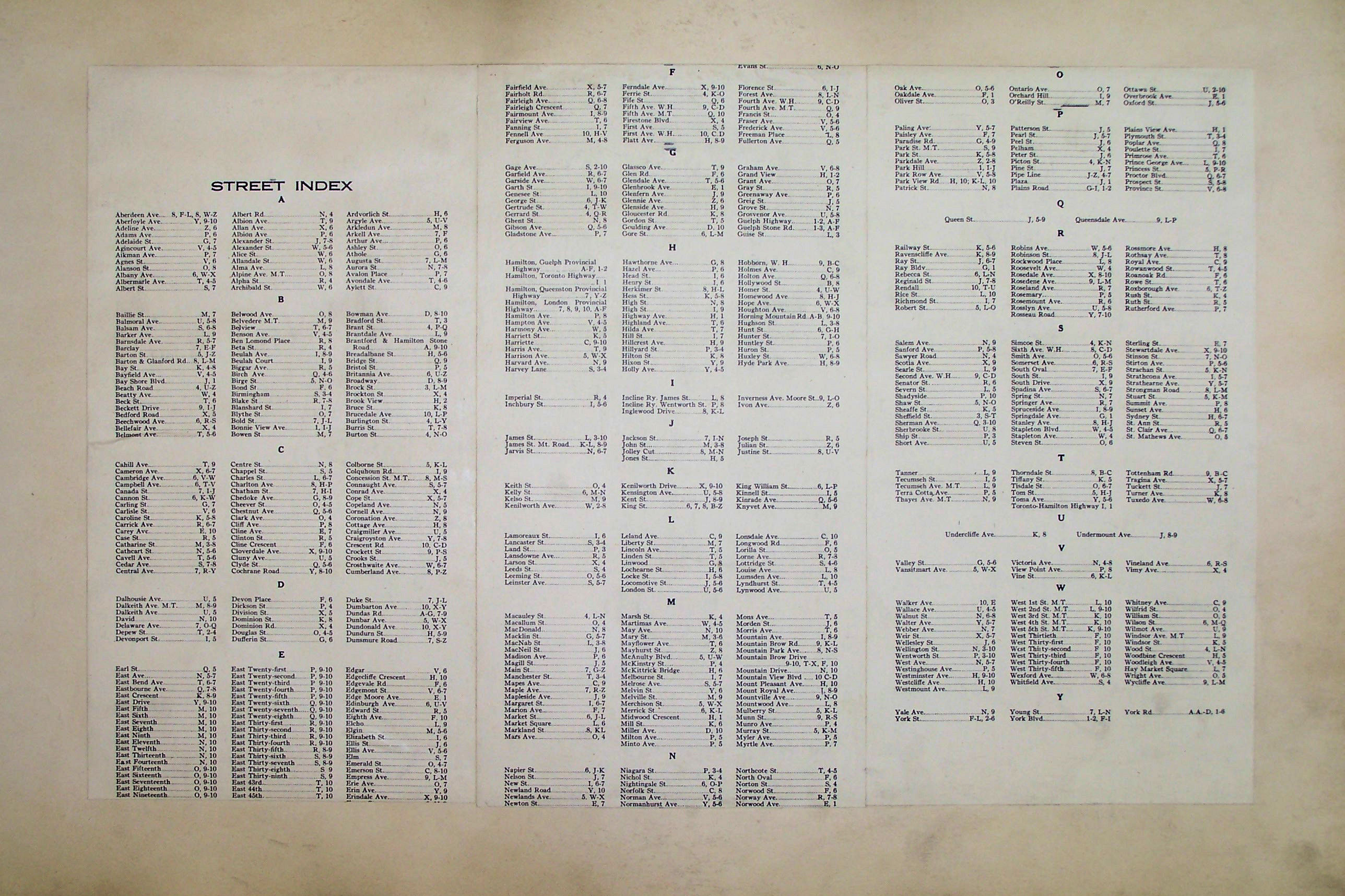
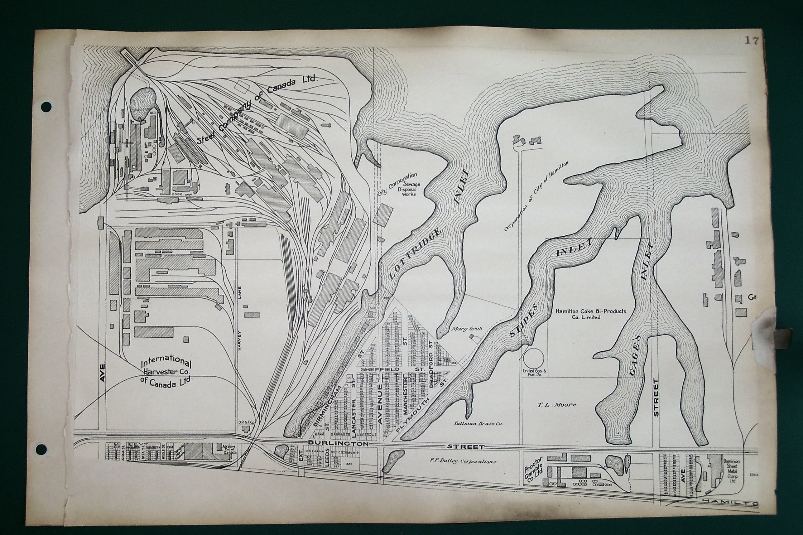
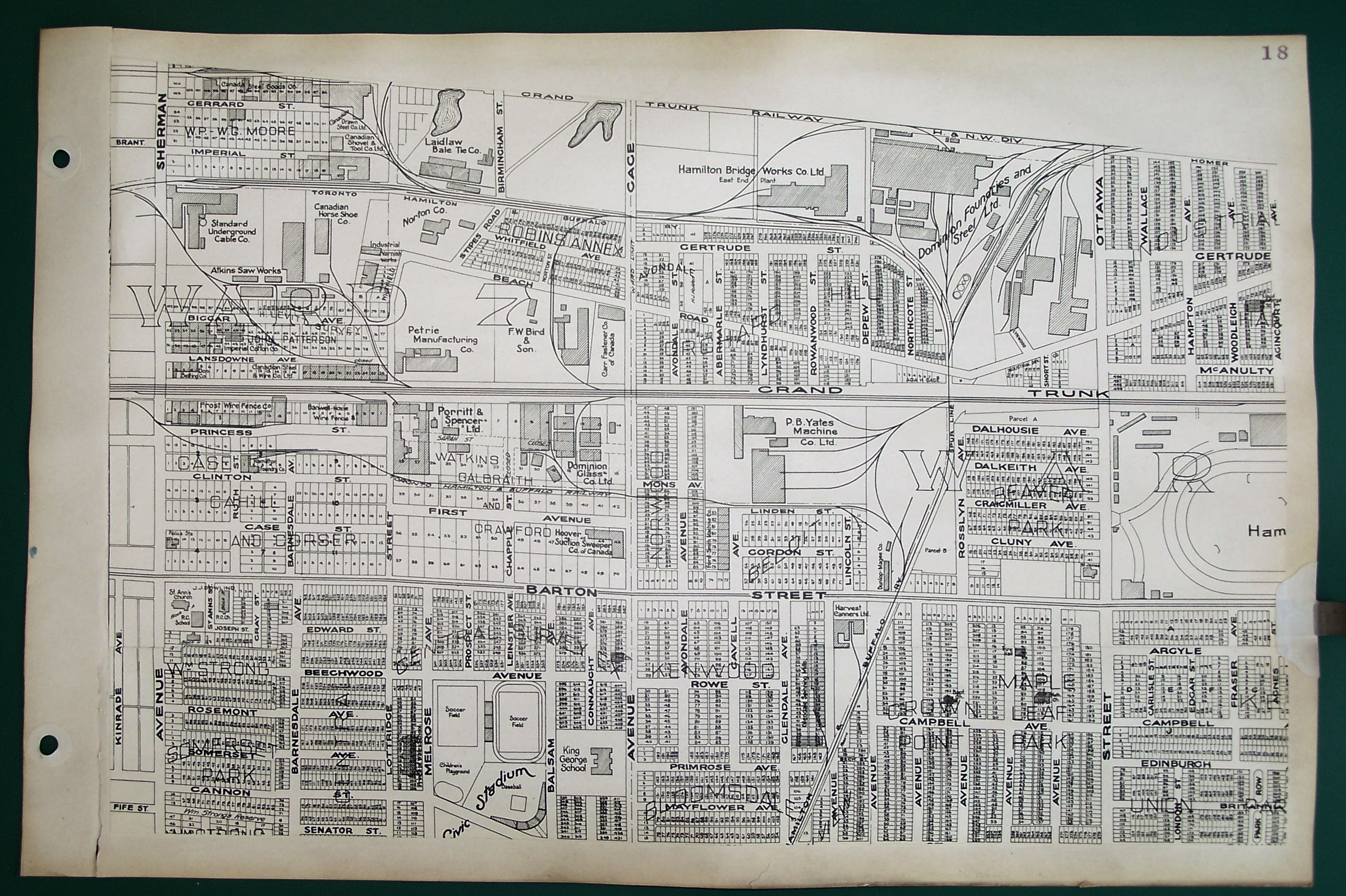
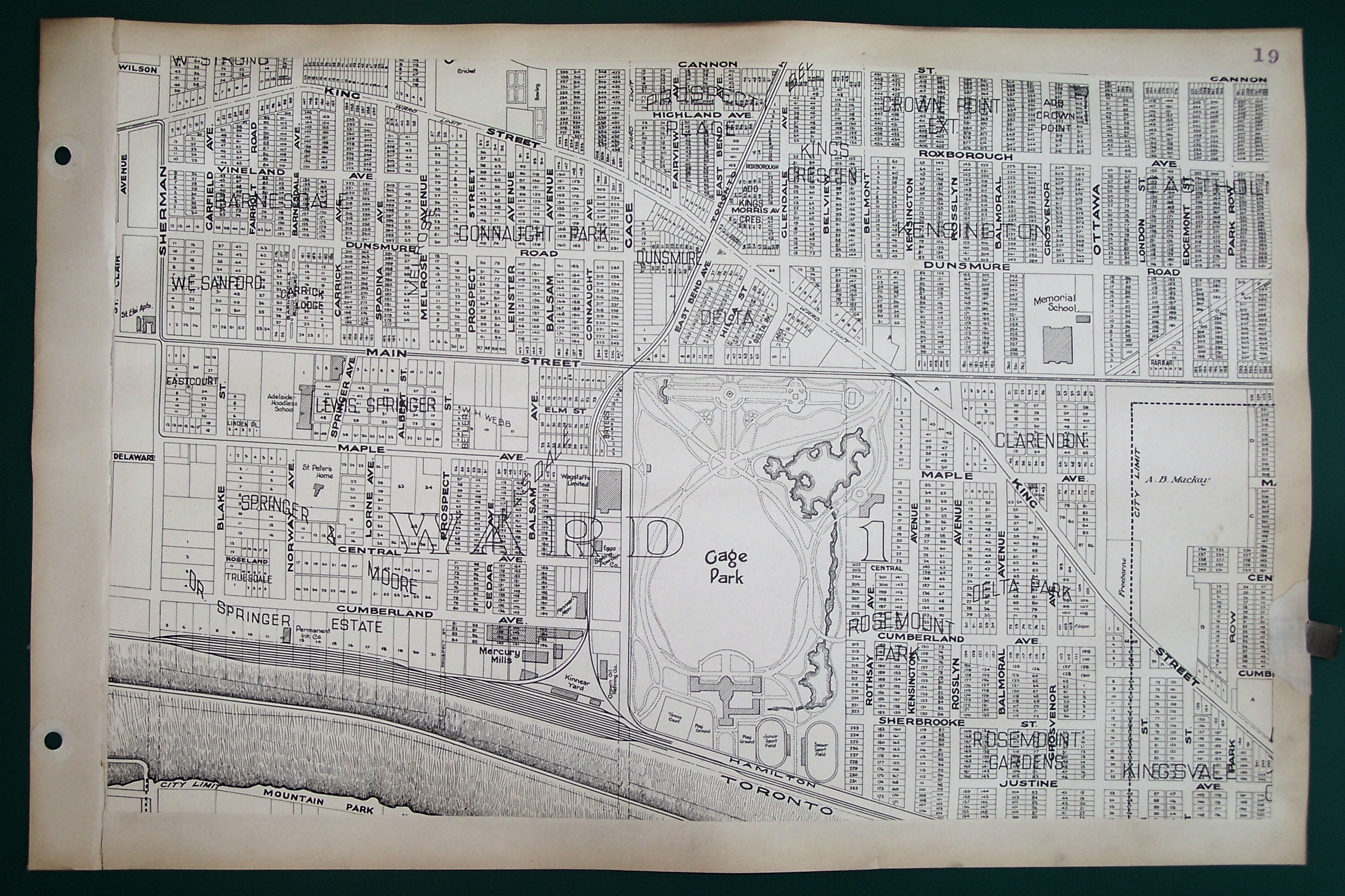
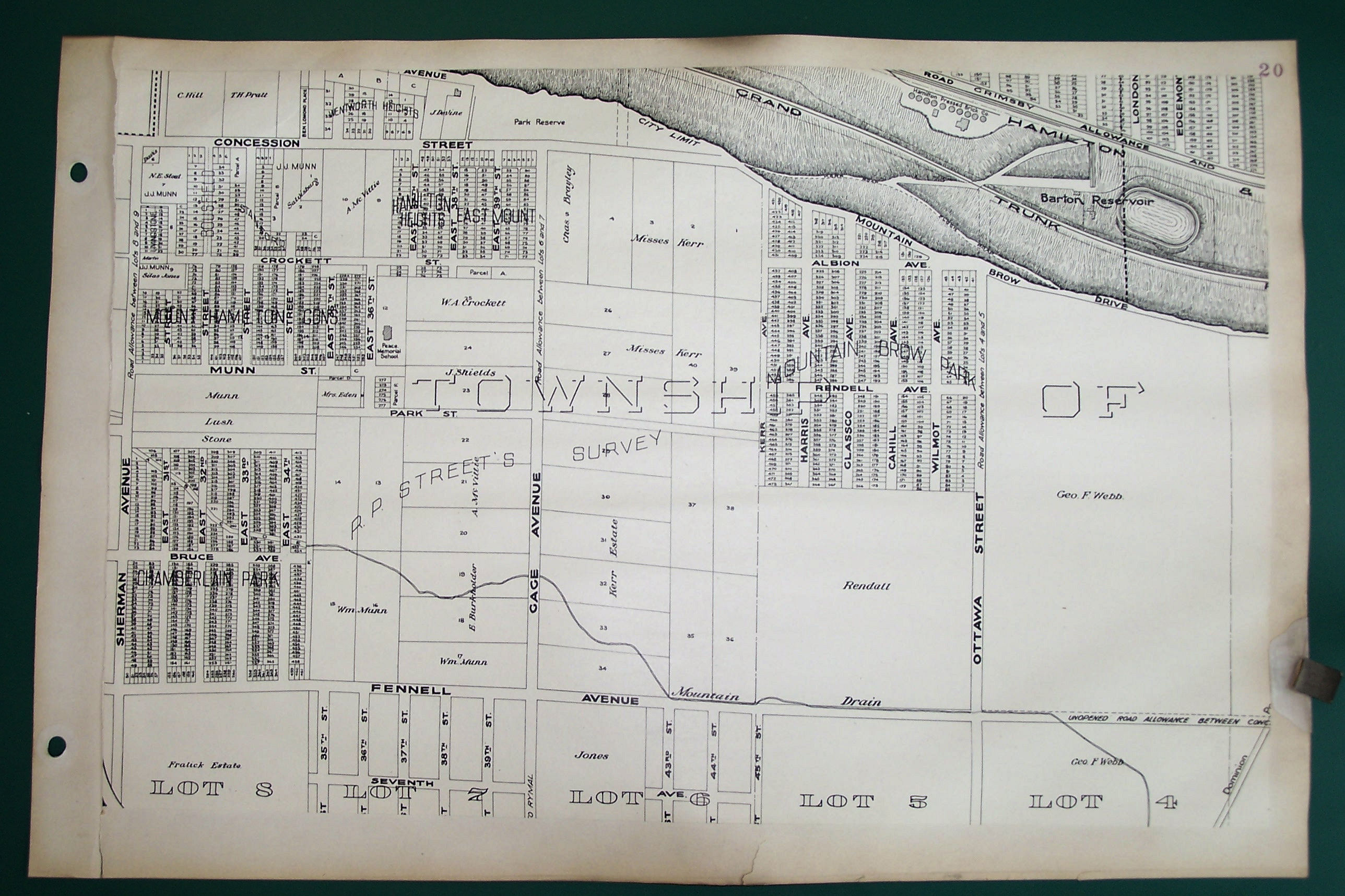
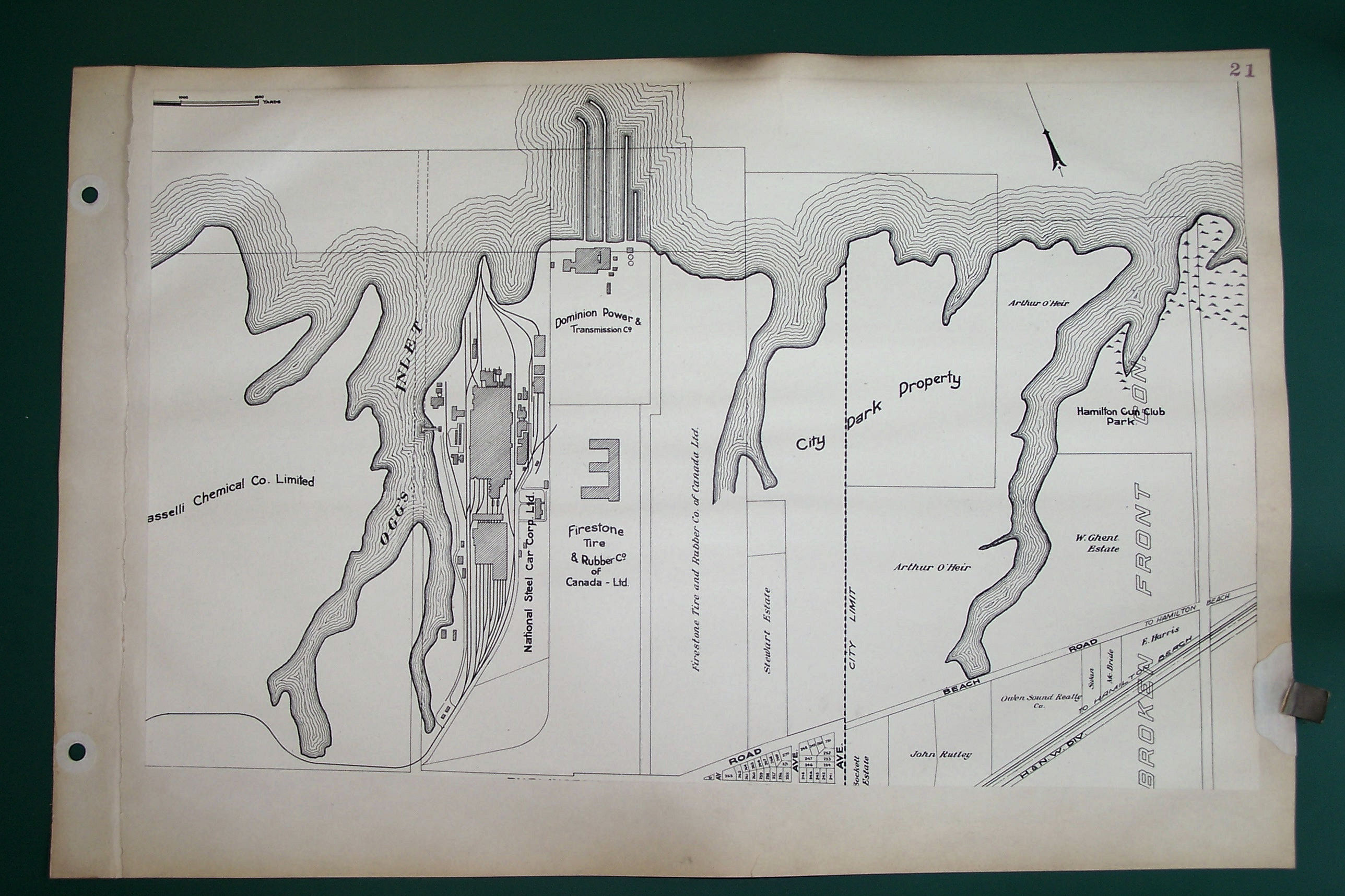
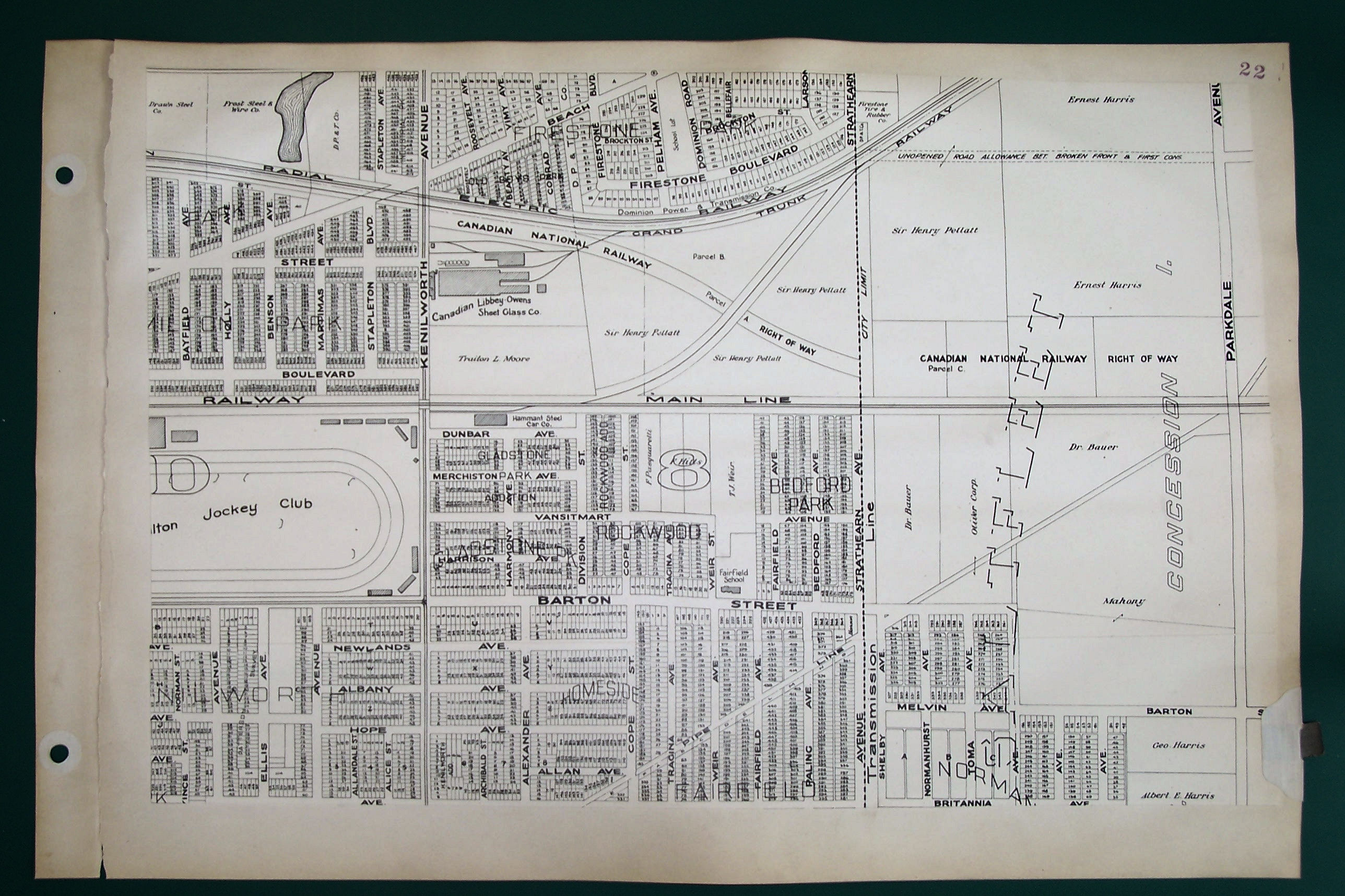
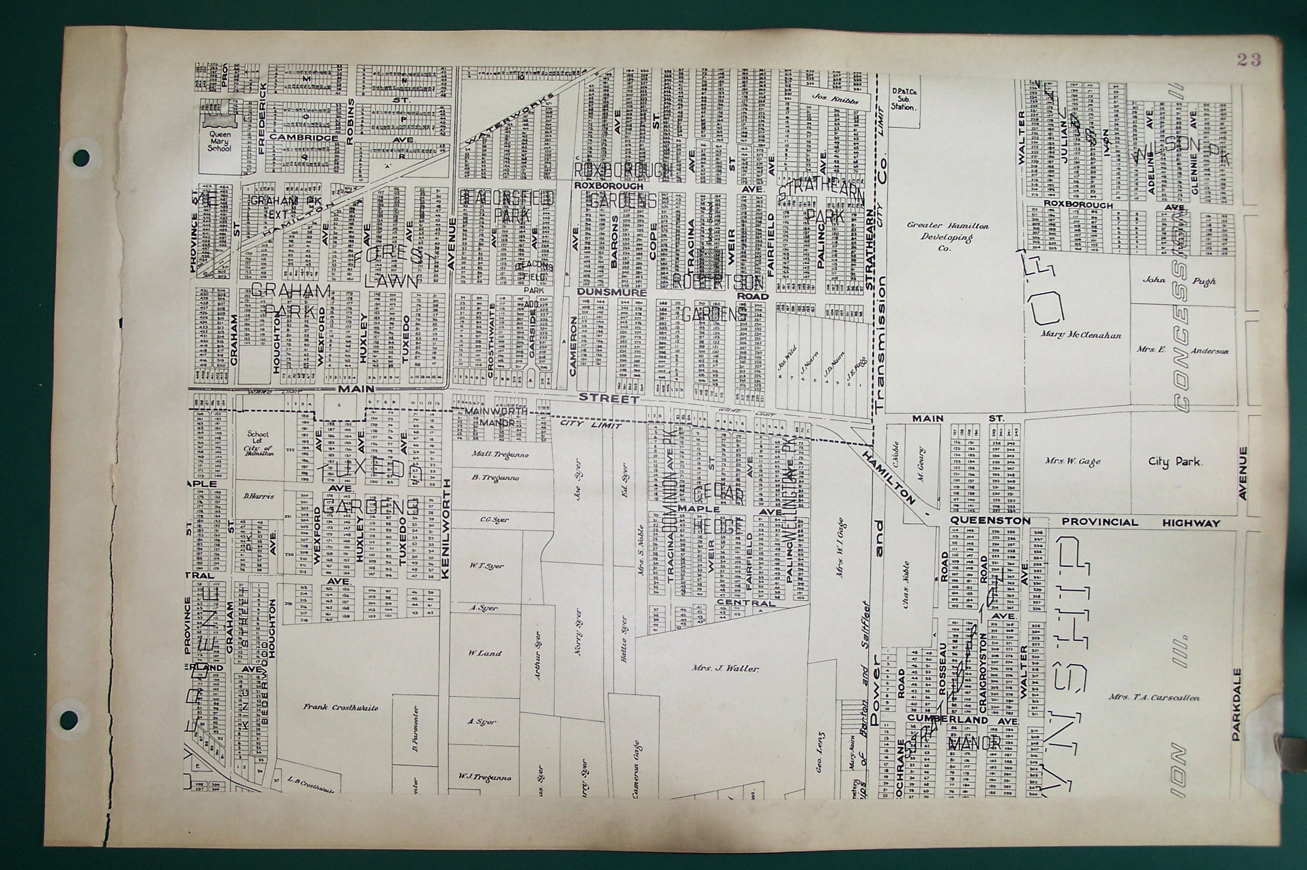
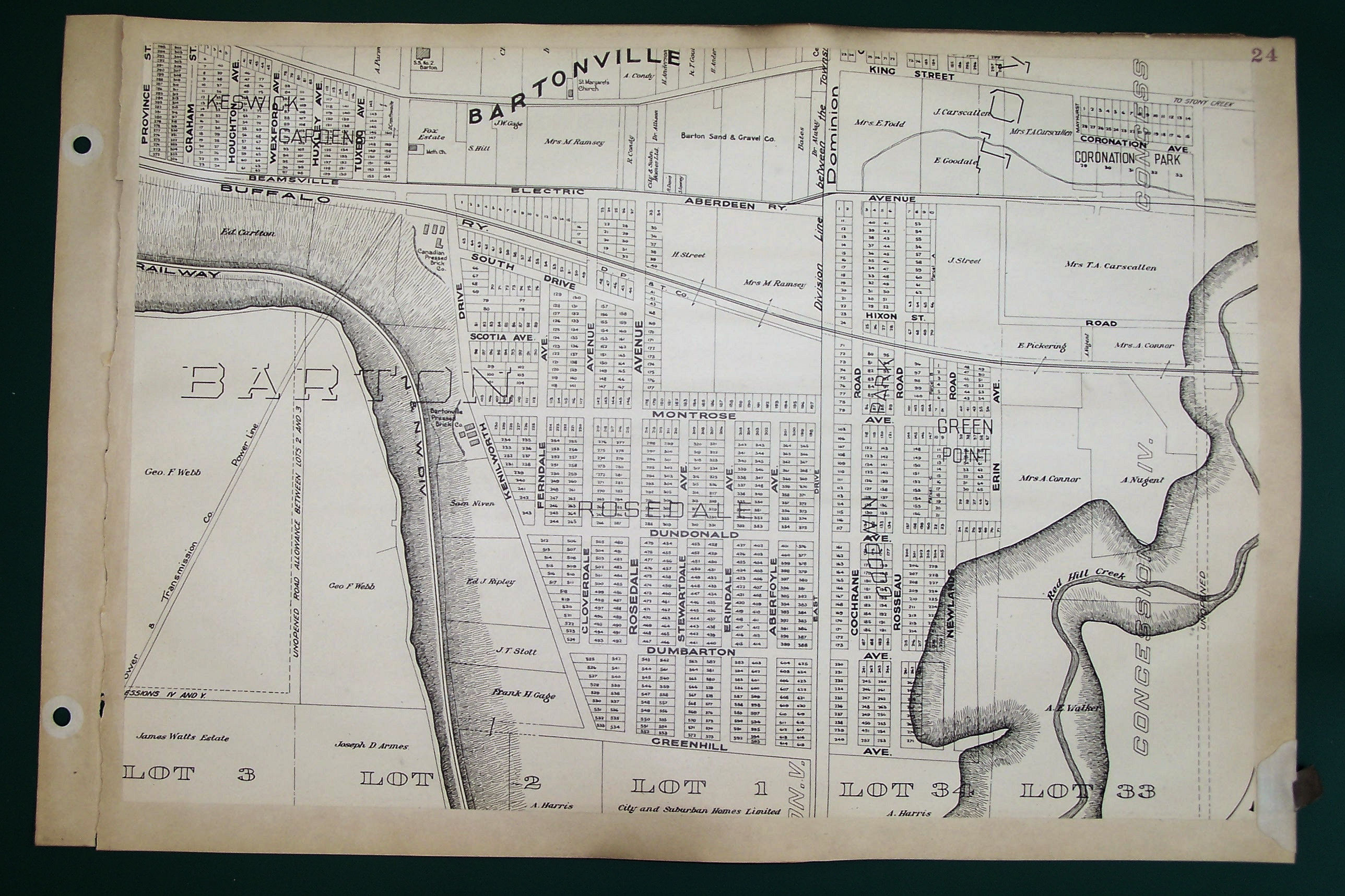
- Printed map bound as an atlas. 28 pages approximately 45 cm x 63 cm, including 24 map plates, 1 index map and two pages of text index (Plan Index and Street Index). Map sections have been mounted on sheets of heavy paper in order to bind them together and many binding edges are in poor condition, with plates separated from binding. Bound into a cover with screw fasteners. Front cover embossed with title in gold.
- 300 Feet = 1 Inch
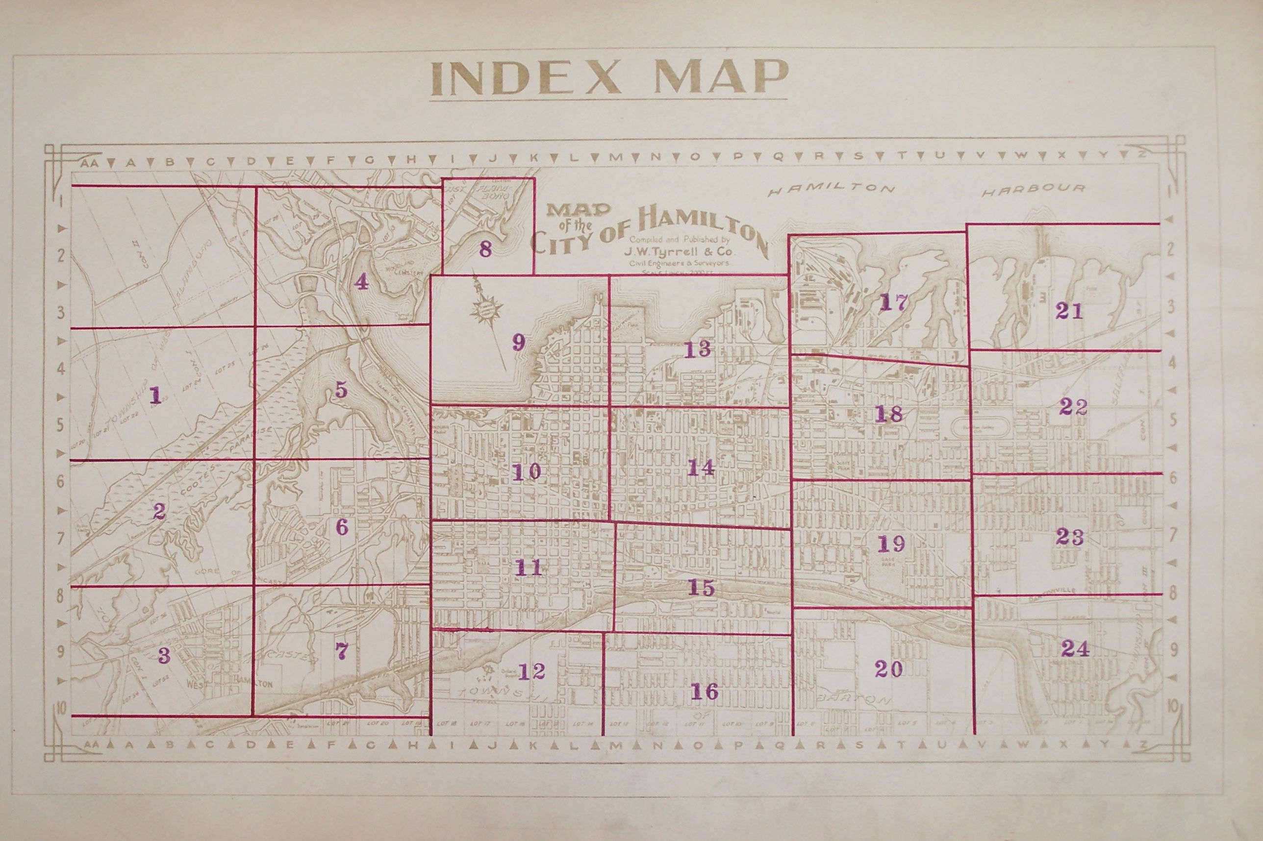
- Appears to have originally been a single large map of the City of Hamilton which has been dissected and mounted on pages for the purpose of creating an atlas format.
- Location: McMaster University Library, Research Collections, G 1149 .H35T97 1924

Contact: mapref@mcmaster.ca