| "Make a Topographic Map" Utility |
Ontario Ministry of Natural Resources and Forestry |
2014 |
|
| 1934 Air Photos of Niagara Region |
Canada Department of Energy, Mines, and Resources |
1934 - 2017 |
|
| ASTER Global Digital Elevation Model (GDEM) |
Produced jointly by Japan's Ministry of Economy, Trade and Industry (METI) and the U.S. National Aeronautics and Space Administration (NASA). |
2011 (version 2) |
|
| Central Ontario Orthopholography Project (COOP) 2016 - 4 bands |
Ontario Ministry of Natural Resources and Forestry |
2016 |
|
| Central Ontario Orthophotography Project (COOP) 2016 Classified LAS |
Ontario Ministry of Natural Resources |
2017 |

|
| Central Ontario Orthophotography Project (COOP) 2016 Digital Elevation Model |
Ontario Ministry of Natural Resources |
2017 |
|
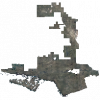
| Central Ontario Orthophotography Project (COOP) 2021 - 1km x 1km coverage |
Ontario Ministry of Natural Resources |
2021 - 2022 |
|
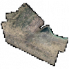
| City of Hamilton Orthophoto Imagery 2019 |
First Base Solutions |
2019 |
|
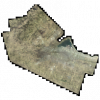
| City of Hamilton Orthophoto Imagery 2021 |
First Base Solutions |
2021 |
|
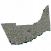
| City of Kingston Orthophotography, 1998 |
Ontario Ministry of Natural Resources |
1998 |
|
| City of Kingston Orthophotography, 2004 |
Ontario Ministry of Natural Resources |
2004 |
|
| City of Kingston Orthophotography, 2011 |
Ontario Ministry of Natural Resources |
2011 |

|
| City of Ottawa Orthophotography, 2005 |
Ontario Ministry of Natural Resources |
2005 |
|
| City of Vancouver Open Data Portal |
City of Vancouver |
Varies by dataset |

|
| County of Simcoe, Muskoka and Dufferin Orthophotography Project, 2008 |
Ontario Ministry of Natural Resources |
2008 |
|
| Digital Raster Acquisition Project Eastern Ontario (DRAPE) 2008-09; 2014 |
Ontario Ministry of Natural Resources |
2008 - 2014 |
|
| Digital Raster Acquisition Project Eastern Ontario (DRAPE) 2014 Classified LAS |
Ontario Ministry of Natural Resources |
2016 |

|
| Digital Raster Acquisition Project Eastern Ontario (DRAPE) 2014 Digital Terrain Model (DTM) |
Ontario Ministry of Natural Resources |
2017 |
|
| Digital Raster Acquisition Project Eastern Ontario (DRAPE) 2019 |
Ontario Ministry of Natural Resources |
2020 - 2021 |
|
| Digital Soil Map of the World and Derived Soil Properties |
Food and Agriculture Association (FAO) and United Nations Educational Scientific Cultural Organization (UNESCO) |
2003 |

|