About the 1:100,000 scale map series:
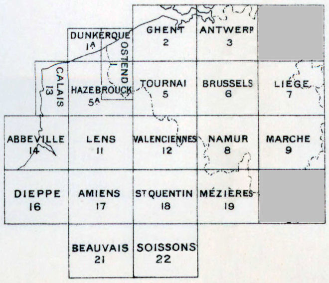
[Belgium and North-East France] GSGS 2364:
"Preparation of the 1:100,000-scale map was begun in England by the Geographical Section of the War Office as early as 1909. At first, the series covered only Belgium and was issued in ten equal-size sheets, except for sheet no.1 (Ostend) which was half size. The series was based on the Belgium 1:40,000 topographic map and was printed in five colours. Contours were drawn at 10-metre intervals.
With the outbreak of the War, the series was extended west and south to cover the entire area of British operations in northeastern France. The extension more than doubled the area covered and added another 12 sheets to the series (some sources suggest a sheet was also produced for Rheims and vicinity, making a total of 23 sheets in the series).
Because the French portion was taken from their more general 1:80,000 map, there are some discrepancies in the level of topographic detail provided for the two countries. However, the 1:100,000 map made up for this problem by being easier to read.
Some of the sheets were produced with shading that helped to accent the topography. Other were provided with eight altitudinal class intervals, which were colour coded in two shades each of green, yellow, orange, and brown. The series also eliminated the problem of having a break in scale at the French-Belgium border."
Concise Guide to Maps of the First World War--Archives Canada (NMC) |