| Census Tracts (CT), 1981 Census of Canada |
Statistics Canada |
1982 |

|
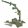
| Central Ontario Orthopholography Project (COOP) 2016 - 4 bands |
Ontario Ministry of Natural Resources and Forestry |
2016 |
|
| Central Ontario Orthophotography Project (COOP) 2016 Classified LAS |
Ontario Ministry of Natural Resources |
2017 |

|
| Central Ontario Orthophotography Project (COOP) 2016 Digital Elevation Model |
Ontario Ministry of Natural Resources |
2017 |

|
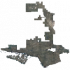
| Central Ontario Orthophotography Project (COOP) 2021 - 1km x 1km coverage |
Ontario Ministry of Natural Resources |
2021 - 2022 |
|
| Children's Treatment Centre Locations |
Ontario Ministry of Health and Long-Term Care |
2013 |

|
| Chimney Point |
DMTI Spatial Inc. |
2015 - 2021 |

|
| China Dimensions Data Collection |
Socioeconomic Data and Applications Center (SEDAC) |
Various, 1949-1996 |

|
| Cinemas Point |
DMTI Spatial Inc. |
2015 - 2021 |

|
| Circonscription électorale fédérale - Fichiers numériques des limites, 2014 (l'Ordonnance de représentation de 2013) |
Élections Canada |
2014 |

|
| City of Calgary's Open Data Portal |
The City of Calgary |
Current |

|
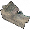
| City of Hamilton Orthophoto Imagery 2019 |
First Base Solutions |
2019 |
|
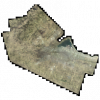
| City of Hamilton Orthophoto Imagery 2021 |
First Base Solutions |
2021 |
|
| City of Kingston Orthophotography, 1998 |
Ontario Ministry of Natural Resources |
1998 |
|
| City of Kingston Orthophotography, 2004 |
Ontario Ministry of Natural Resources |
2004 |
|
| City of Kingston Orthophotography, 2011 |
Ontario Ministry of Natural Resources |
2011 |

|
| City of Montreal Uniform Crime Reporting Data |
Canadian Centre for Justice Statistics |
2001 |
|
| City of Ottawa Orthophotography, 2005 |
Ontario Ministry of Natural Resources |
2005 |

|
| City of Toronto Fire Insurance Plans (1910) - Georeferenced |
Original maps by Goad's Atlas and Plan Co. (Goad, Charles E.)
Georeferenced by McMaster University Lloyd Reeds Map Collection |
1910 |
|
| City of Toronto Open Data |
City of Toronto |
Varies by dataset |

|