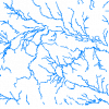
| Hydrography - Lines (HYL) |
DMTI Spatial Inc. |
2001 - 2014 |
|
| Topographic Boundaries (TOP) |
DMTI Spatial Inc. |
2001 - 2014 |

|
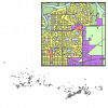
| Land Use (LUR) |
DMTI Spatial Inc. |
2001 - 2014 |
|
| Hydrographic Structures - Regions (HSR) |
DMTI Spatial Inc. |
2001 - 2014 |

|
| CanMap Rail (RL) |
DMTI Spatial Inc. |
2002 - 2014 |

|
| Local Delivery Unit Boundaries (LDU) |
DMTI Spatial Inc. |
2006 - 2014 |

|
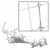
| Major Roads and Highways (HRD) |
DMTI Spatial Inc. |
2001 - 2014 |
|
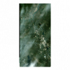
| DMTI Satellite StreetView (SSV) - Whitehorse, Yukon |
DMTI Spatial Inc. |
2008 |
|
| Industrial and Resource - Regions (IRR) |
DMTI Spatial Inc. |
2001 - 2014 |

|
| Local Delivery Unit Boundaries Lookup Table |
DMTI Spatial Inc. |
2007 - 2014 |
|
| Unique Enhanced Postal Codes (UEP) |
DMTI Spatial Inc. |
2001 - 2006 |

|
| Roads Look Up Table - csd96 (rds_csd96) |
DMTI Spatial Inc. |
2006 - 2014 |
|
| DMTI Satellite StreetView (SSV) - Manitoba |
DMTI Spatial Inc. |
2005 - 2012 |
|
| Car Pool Parking Lots (CPL) |
DMTI Spatial Inc. |
2001 - 2014 |
|
| Wetlands (WER) |
DMTI Spatial Inc. |
2001 - 2014 |

|
| Multiple Enhanced Postal Codes (MEP) |
DMTI Spatial Inc. |
2001 - 2014 |

|
| Capital Cities (CAP) |
DMTI Spatial Inc. |
2004 - 2014 |

|
| Parks and Recreation - Points (PRP) |
DMTI Spatial Inc. |
2001 - 2014 |
|
| Aerodromes (AER) |
DMTI Spatial Inc. |
2002 - 2014 |

|
| Provincial Boundaries (PRV) |
DMTI Spatial Inc. |
2001 - 2014 |

|