Geospatial Data
| Title Sort descending | Author | Year | Sample |
|---|---|---|---|
| Atlas of the Biosphere | The Nelson Institute Center for Sustainability and the Global Environment, University of Wisconsin-Madison |
1998 - 2001 | |
| Bait Harvest Area | Ontario Ministry of Natural Resources | 2006 - 2012 | 
|
| BatchGeo | BatchGeo LLC |
Current | |
| Bathmen, Eastern Holland. 1:25,000. Map Sheet 3703, 1st Edition, Geological Overprint, 1944 | United States. Army Map Service | 1944 | 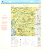
|
| Bear Management Area | Ontario Ministry of Natural Resources | 1997 - 2013 | 
|
| Beaver Dam | Ontario Ministry of Natural Resources | 1976 - 2008 | 
|
| Bedrock Geology of Ontario - 1:250,000 | Ontario Ministry of Northern Development and Mines | 2003 | 
|
| Berneval, France. 1:12,500. Map Sheet, Home Forces 23, 3rd Edition, June 1942 | Great Britain. War Office. GHQ Home Forces | 1942 | 
|
| Blitterswijk, Eastern Holland. 1:25,000. Map Sheet 4402, 3rd Edition, Defence Overprint, 6 February 1945 | United States. Army Map Service | 1945 | 
|
| Blitterswijk, Eastern Holland. 1:25,000. Map Sheet 4402, 3rd Edition, Engineer Overprint, December 1944 | United States. Army Map Service | 1944 | 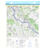
|
| Block-Face Points (BF), 1991 Census | Statistics Canada | 1992 | 
|
| Block-Face Points (BF), 1996 Census | Statistics Canada | 1997 | 
|
| Blocked Passage Barrier Point | DMTI Spatial Inc. | 2015 - 2021 | 
|
| Border Crossings and Offices Point | DMTI Spatial Inc. | 2015 - 2021 | 
|
| Borehole - Retired | Ontario Ministry of Northern Development, Mines and Forestry | 1875 - 2010 | 
|
| Boundary Files, 1911 Census of Canada | Canadian Century Research Infrastructure | 2011 - 2013 | 
|
| Boundary Files, 1921 Census of Canada | Canadian Century Research Infrastructure | 2011 - 2013 | 
|
| Boundary Files, 1931 Census of Canada | Canadian Century Research Infrastructure | 2011 - 2013 | 
|
| Boundary Files, 1941 Census of Canada | Canadian Century Research Infrastructure | 2011 - 2013 | 
|
| Boundary Files, 1951 Census of Canada (CCRI) | Canadian Century Research Infrastructure | 2011 - 2013 | 
|