Geospatial Data
| Title Sort descending | Author | Year | Sample |
|---|---|---|---|
| "Make a Topographic Map" Utility | Ontario Ministry of Natural Resources and Forestry |
2014 | |
| 1934 Air Photos of Niagara Region | Canada Department of Energy, Mines, and Resources | 1934 - 2017 | 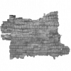
|
| 2020 Land Cover of Canada | CCRS, CCMEO, NRCAN | 2022-2024 | |
| Aboriginal Boundaries Bands Table | DMTI Spatial Inc. | 2018 - 2023 | |
| Aboriginal Boundaries Region | DMTI Spatial Inc. | 2015 - 2023 | 
|
| Aboriginal Lands of Canada Legislative Boundaries | Natural Resources Canada | 2017 | 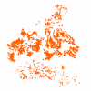
|
| Accommodations Point | DMTI Spatial Inc. | 2015 - 2023 | 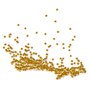
|
| Address Delta Point | DMTI Spatial Inc. | 2017 - 2023 | 
|
| Administrative Area Region | DMTI Spatial Inc. | 2015 - 2023 | 
|
| Administrative Boundary Lines - Provincial and Territory | DMTI Spatial Inc. | 2015 - 2023 | 
|
| Aerial Cableway Line | DMTI Spatial Inc. | 2015 - 2023 | 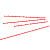
|
| Aerodromes (AER) | DMTI Spatial Inc. | 2002 - 2014 | 
|
| Aggregate Designated Area | Ontario Ministry of Natural Resources | 2007 | 
|
| Aggregate Inspector Jurisdiction | Ontario Ministry of Natural Resources | 2007 | 
|
| Aggregate Site Authorized | Ontario Ministry of Natural Resources | 1990 - 2006 | 
|
| Aggregate Sites - Ministry of Transportation (MTO) | Ontario Ministry of Transportation | 2013 | 
|
| Agreement Forest Area | Ontario Ministry of Natural Resources | 1997 - 2004 | 
|
| Agricultural Land - Replaced | Ontario Ministry of Natural Resources | 1998 - 2012 | 
|
| Agricultural Operation Inventory | Ontario Ministry of Natural Resources | 2010 - 2012 | 
|
| Agricultural Resource Inventory (ARI) - 1983 | Ontario Ministry of Agriculture, Food, and Rural Affairs | 2003 - 2010 | 
|
