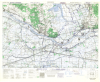
| Wesel, Germany. 1:25,000. Map Sheet 4305, 3rd Edition, Defence Overprint, 12 February 1945 |
Great Britain. War Office. General Staff. Geographical Section. |
1945 |

|
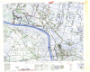
| Leiden East, Holland. 1:25,000. Map Sheet 365, Defence Overprint, 12 April 1945 |
United States. Army Map Service |
1945 |
|
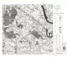
| Rheinberg, Germany. 1:25,000. Map Sheet 4405, 3rd Edition, Defence Overprint, 22 January 1945 |
Great Britain. War Office. General Staff. Geographical Section. |
1945 |
|
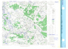
| Groesbeek South, Holland. 1:12,500. Map Sheet 12 NW/6, 1st Edition, Defence Overprint, 2 February 1945 |
Canada. Royal Canadian Engineers |
1945 |
|
| Geldern, Eastern Holland. 1:25,000. Map Sheet 4403, 3rd Edition, Defence Overprint, 18 February 1945 |
United States. Army Map Service |
1945 |
|
| Renen, Holland. 1:25,000. Map Sheet 5 NE, 2nd Edition, Defence Overprint, 27 March 1945 |
United States. Army Map Service |
1945 |
|
| Gennep, Holland. 1:12,500. Map Sheet 12 SW/3, 1st Edition, Defence Overprint, 20 January 1945 |
Canada. Royal Canadian Engineers |
1945 |
|
| Issum, Germany. 1:25,000. Map Sheet 4404, 3rd Edition, Defence Overprint, 6 February 1945, Version 1 |
Great Britain. War Office. General Staff. Geographical Section. |
1945 |
|
| Meppen, Germany. 1:25,000. Map Sheet 3309, 2nd Edition, Defence Overprint, 14 February 1945 |
Great Britain. War Office. General Staff. Geographical Section. |
1945 |

|
| Xanten, Germany. 1:25,000. Map Sheet 4304, 3rd Edition, Defence Overprint, 20 February 1945 |
Great Britain. War Office. General Staff. Geographical Section. |
1945 |
|
| Emden, Germany. 1:25,000. Map Sheet 2609, 2nd Edition, Defence Overprint, 11 April 1945 Version 2 |
Great Britain. War Office. General Staff. Geographical Section. |
1945 |

|
| Rees, Germany. 1:25,000. Map Sheet 4204, 3rd Edition, Defence Overprint, 6 February 1945 |
Great Britain. War Office. General Staff. Geographical Section. |
1945 |

|
| Canadian Digital Elevation Model (CDEM) |
Natural Resources Canada |
1945-2011 |
|
| Quaternary Geology of Ontario |
Ontario Ministry of Northern Development and Mines |
1950 - 1988 |

|
| Ontario In-filled Climate Data |
Ontario Ministry of Natural Resources |
1950 - 2005 |

|
| Southern Ontario Land Use (circa 1966) - Canada Land Inventory (1:50,000) |
Ducks Unlimited Canada |
1950 - 2009 |

|
| Historical Topographic Maps: 1:50,000 Index |
National Resources Canada (NRCan) / Ministère des Ressources naturelles Canada (RNCan) |
1950 - 2020 |
|
| Boundary Files, 1951 Census of Canada (Statistics Canada) |
Statistics Canada |
1951 - 2013 |

|
| Historical Topographic Maps 1:25,000 Index |
Surveys and Mapping Branch, Department of Energy, Mines and Resources |
1956 - 2016 |
|
| Unorganized Area G-Plan Index |
Ontario Ministry of Natural Resources |
1960 - 2000 |

|