Breadcrumb
Geospatial Data
| Title | Author | Year Sort descending | Sample |
|---|---|---|---|
| Railway | Ontario Ministry of Natural Resources | 1977 - 2012 | 
|
| Road Segment at 1 Million | Ontario Ministry of Natural Resources | 1983 | 
|
| MNR Road Segment | Ontario Ministry of Natural Resources | 1985 - 2007 | 
|
| MNR Road Barrier | Ontario Ministry of Natural Resources | 1985 - 2009 | 
|
| Street Network File (SNF), 1986 Census | Statistics Canada | 1988 | 
|
| Tactical Pilotage Charts (TPC) | LAND INFO Worldwide Mapping, LLC |
1989 | |
| Road at 600K | Ontario Ministry of Natural Resources | 1995 | 
|
| Airport - Replaced | Ontario Ministry of Natural Resources | 1997 - 2006 | 
|
| Vector Map Level 0 (VMap0) | LAND INFO Worldwide Mapping, LLC |
2000 | |
| Transportation Related - Lines (TAL) | DMTI Spatial Inc. | 2001 - 2003 | |
| Bus Transit - Lines (BTL) | DMTI Spatial Inc. | 2001 - 2003 | |
| Rail Transit - Lines (RTL) | DMTI Spatial Inc. | 2001 - 2003 | |
| Transportation Related - Points (TAP) | DMTI Spatial Inc. | 2001 - 2003 | |
| Bus Transit Points (BTP) | DMTI Spatial Inc. | 2001 - 2003 | |
| Rail Transit - Points (RTP) | DMTI Spatial Inc. | 2001 - 2003 | |
| Transportation Related - Regions (TAR) | DMTI Spatial Inc. | 2001 - 2003 | |
| Ontario Road Network Road Net Element (ORN) | Ontario Ministry of Natural Resources | 2001 - 2012 | 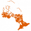
|
| Exit Points (XIT) | DMTI Spatial Inc. | 2001 - 2014 | 
|
| Trail Casements (TLC) | DMTI Spatial Inc. | 2001 - 2014 | 
|
| Major Road Casements (MRC) | DMTI Spatial Inc. | 2001 - 2014 | 
|
Pagination
- Page 1
- Next page
