
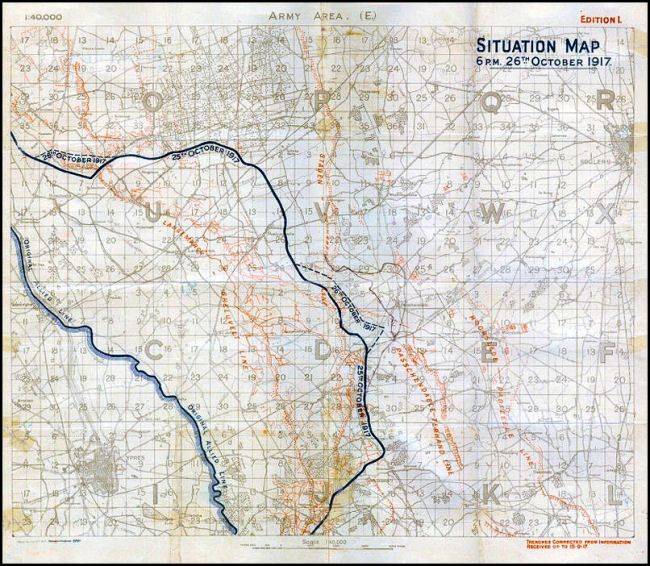
| Specialty Maps: "Situation" |
| In 1916 daily "Situation" maps were created for the first time for the Battle of Arras. Situation maps were also produced to show networks of ammunition dumps and railways. |
| The image below is taken from a map in our collection (ID #362ww1map). |
 |
Contact: mapref@mcmaster.ca