
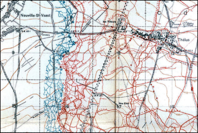
| Front 200 Yards of Trenches Only |
| From the beginning of the war in 1914 until some time in 1916 British trenches, except for the front line, were not allowed to be printed on maps in case they fell into enemy hands. As many of their own men became lost in their own trench networks they began to permit the first 200 yards of trenches to be shown. Finally, in 1917 all trenches which could be discerned from aerial photographs were allowed to be printed on maps. |
| The image below was taken from a map in our collection (ID #013ww1map). |
 |
Contact: mapref@mcmaster.ca