
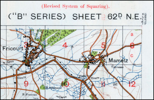
| "B" Series Maps |
| In 1914 the British experimented with maps which imposed their own grid lines of 1,000 yard "artillery" squares on reproductions of Belgian maps which were created on metric sheet lines. This resulted in an improper fit and created problems when trying to plot targets over 2 or more map sheets as the grids did not align. This experiment was called the "B" series and was later dropped. |
| The image below was taken from a map in our collection (ID #100ww1map). Notice how the grid extends upwards past the edge of the base map. |
 |
Contact: mapref@mcmaster.ca