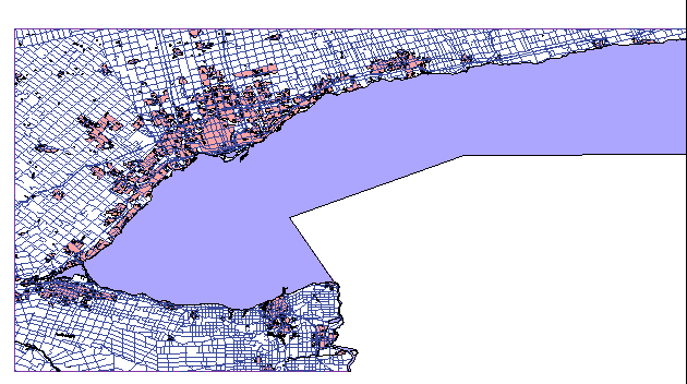
National Topographic
Data Base
Digital Topographic Maps 1:250,000 -
Source:
- Natural Resources Canada, Geomatics Canada, Centre for Topographic Information.
-
- Available for free download from GeoGratis
http://www.geogratis.ca/geogratis/en/index.html
-
- Back
To Top
-
Description:
- Topographic
map tiles, equivalent to Canada 1:250,000 National Topographic System maps in
paper format (available in the Map Collection).
Digital tiles have the same numbering scheme as the paper maps. Indexes
are available in the Map Collection, or at the Natural
Resources Canada website.
Features shown on the paper maps are presented
as individual themes in the digital format.
Every map tile includes approximately
35 themes (see Attributes section).
Attributes may vary
from tile to tile, depending on the geography represented.
Projection: Geographic (latitude/longitude)
Date: varies for each map sheet (see metadata for the individual sheet)
File format:
ESRI shape file
- Back
To Top
-
Metadata:
- Copies
of these reports are also available in the Map Collection:
- 1)
Natural Resources Canada, Centre for Topographic Information, National
Topographic Data Base - Edition 3.1: Simplified User's Guide, (April 2001).
-
- 2)
Natural Resources Canada, Centre for Topographic Information, Standards
and Specifications of the National Topographic Data Base, Edition 3.1, (1996).
-
- 3)
Natural Resources Canada, Centre for Topographic Information, National
Topographic Data Base: Data Dictionary, Edition 3.1, (May 1996).
-
- 4)
Natural Resources Canada, Centre for Topographic Information, National
Topographic Data Base: Metadata Format - NTDB Edition 3, (May 2000).
-
- 5)
Each map tile comes with a metadata file, specific to that map sheet. These metadata files can be viewed on the GeoGratis website, and will be included in html format with each zipped map sheet.
-
Back To Top-
Attribute Fields in
These Coverages - 3) For additional information on specific attributes,
see Natural Resources Canada, Centre for Topographic Information, National
Topographic Data Base: Data Dictionary.
-
-
Coverage Name and Description
(For sheet 30M - Each
sheet will vary) | Attributes |
breakwal (Breakwater)
| -
| | buildin_p
(Building - point coverage) | building function, angle
|
builtup_a (Built-Up Area - polygon coverage) (Sample)
| centroid coordinates
| builtup_p (Built-Up Area
- point coverage) (Sample)
| centroid
coordinates
| campgro_p (Campground - polygon coverage)
| centroid coordinates
| chimney_p (Chimney - point
coverage)
| -
| contour_l (Contour Lines) (Sample)
| elevation
| dam_p (Dam - point coverage)
| dam
type, angle
| | elev_ptp (Elevation Point, Spot Height) | elevation
| haz_air_p (Hazard to Air Navigation - point coverage)
| type of hazard, height
| haz_nav_p (Hazard to Navigation,
Inland Waters - point coverage)
| -
| hi_site_p
(Historic Site or Point of Interest)
| -
| li_road_l
(Limited-Use Road)
| classification
| mininga_a
(Mining Area)
| nature, type, status
| n_canal_a
(Navigable Canal)
| status, centroid coordinates
|
nav_aid_p (Navigational Aid)
| type
| nts_lim_l
(NTS Territorial Limits or Neat Line)
| -
| picnic_p
(Picnic Site)
| -
| | pipelin_l (Pipeline) | product,
relationship to ground, number of pipelines
| | railway_l
(Railway) | gauge, relationship to ground, status, type
|
road_l (Road) (Sample)
| classification,
support, surface, status, number of lanes, first road number, second road number
| runway_p (Runway)
| category, status, surface
| | toponym_p (Toponyms) | type, CGNDB identifier, name
| tower_p (Tower)
| -
| trail_l
(Trail)
| -
| | trans_l_l | line function,
location, number of lines
| | trans_s_p (Transformer Station
- point coverage) (see Transmission Line sample) | -
|
| vegetat_a (Vegetation) | type, centroid coordinates
|
wat_dis_a (Water Disturbance - area coverage)
| type, x and y centroids
| wat_dis_l (Water Disturbance - line coverage)
| type
| wat_dis_p (Water Disturbance - point coverage)
| type,
angle
| | water_b_a (Water Bodies) | type, x and y centroids
| | water_c_l (Watercourses) | type | wetlanda
(Wetland)
| centroid coordinates
| wharf_l (Wharf)
| -
|
- Back To
Top
-
Demo Location:-
A demonstration copy of one tile showing these coverages is mounted on the ArcView
workstation in the Map Collection.
h:/datademos/ntdb/demo.apr
(View=NTDB 1:250,000 Demo - 30M Sheet (GeoGratis version))
 Back To Top
How To Obtain
These Files:
- The map must be requested by NTS map sheet number. Indexes are available in the Map collection, or click here to see an index of available sheets.
- The map tiles can be downloaded directly from the GeoGratis website: http://www.geogratis.ca/geogratis/en/index.html
-
Back
To Top
Hamilton
index
Ontario
Canada
Geospatial Data Geography index
|


