
|
| Lloyd Reeds Map Collection |
| Geospatial Data Available from the McMaster University Library |
Source:
Regional Municipality of Niagara, Public Works Department, Information Management Systems and Communications. April 2000. Description:
Digital black and white orthophotos (orthorectified aerial photography), covering the Regional Municipality of Niagara.
Coverage was flown in April 2000 at the scale of 1:20,000.
Resolution: 31 cm.
Datum: NAD 83.
The original data consisting of 2.0 x 3.3 km tiles has been mosaic'd into 12 regions, one for each township or city. McMaster's copy of the data consists of 12 mosaic files. Each township and city is represented by a separate file: Fort Erie, Grimsby, Lincoln, Niagara Falls, Niagara on the Lake, Pelham, Port Colborne, St. Catharines, Thorold, Wainfleet, Welland, West Lincoln.
File format: MrSid compressed geotif. Can be used in ArcView with the MrSid extension. Metadata:
A metadata document accompanies the data (Digital_Ortho_Mosaic.htm). A printed copy is available in the Map Collection. Attribute Fields in These Data Files:
There are no attributes associated with digital images. Demo Location:
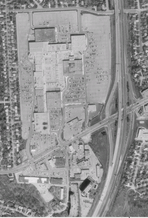
The digital orthophotos may be viewed in the Map Collection, using the MrSid Geoviewer on the ArcView workstation (Start, Programs, MrSid Geoviewer - h:/airphotos/niagara). Click here to view a sample image of Brock University campus. How to Obtain These Files:
1) Digital orthophotos of London are licensed to McMaster University Library by the Regional Municipality of Niagara. They are available only to students, faculty and staff of McMaster University, and may be used only for educational and non-commercial purposes.
Hamilton
Index
| ||||||
| Contact:
mapref@mcmaster.ca
|