
|
| Lloyd Reeds Map Collection |
| Geospatial Data Available from the McMaster University Library |
Global GIS
Source:
Global GIS: A Digital Atlas of Planet Earth. United States Geological Survey. Digital Data Series. 7 CD-ROMs. 2000-2003.
Specific Titles:
A) Hearn, P. Et al. Global GIS Database: Digital Atlas of Central and South America. United States Geological Survey, Digital Data Series DDS-62-A. 2000.
B) Hearn, P. Et al. Global GIS Database: Digital Atlas of Africa. United States Geological Survey, Digital Data Series DDS-62-B. 2001
C) Hearn, P. Et al. Global GIS Database: Digital Atlas of South Asia. United States Geological Survey, Digital Data Series DDS-62-C. 2001.
D) Hearn, P. Et al. Global GIS Database: Digital Atlas of South Pacific. United States Geological Survey, Digital Data Series DDS-62-D. 2001.
E) Hearn, P. Et al. Global GIS: North Eurasia. United States Geological Survey, Digital Data Series DDS-62-E. 2003.
F) Hearn, P. Et al. Global GIS: North America. United States Geological Survey, Digital Data Series DDS-62-F. 2003.
G) Hearn, P. Et al. Global GIS: Europe. United States Geological Survey, Digital Data Series DDS-62-E. 2003. Description:
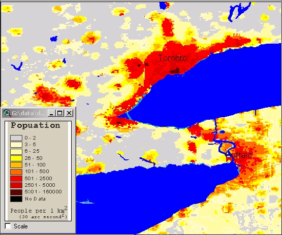
Base GIS data for the world, divided into regions on seven CD-ROMs. These data are developed from small scale maps (1:1 million).
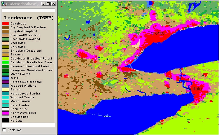
The CDs also include images (in .tif format): Greenness (Normalized Difference Vegetation Index) images, Population, Lights at Night, Slope
Map file formats: ArcView shapefiles. Metadata:
The Global GIS product comes with its own ArcView based software. Metadata files (in html format) are most easily accessed using the supplied software. There is a metadata file for every theme in these coverages. A complete list of data themes (datasets.htm) and several sample metadata documents are available in the Map Collection. For complete metadata, consult the relevant CD-ROM. Attribute Fields in These Data Files:
The following themes are included for every region:
Demo Location:
These datasets may be previewed in the Map Collection. The CD-ROM for the desired region must be inserted prior to starting ArcView. Use the prepared software for best results (Start, Programs, Global GIS) How to Obtain These Files:
1) Limitations on use of individual data themes are described in each metadata file.
2) The CD-ROMs are available for loan to McMaster researchers and students, with valid ID.
Hamilton Index
| ||||||
| Contact:
mapref@mcmaster.ca
|