
|
| Lloyd Reeds Map Collection |
| Geospatial Data Available from the McMaster University Library |
Soil and Physiographic Database for North and Central Eurasia
Source:
United Nations. Food and Agriculture Organization (FAO). Soil and Physiographic Database for North and Central Eurasia (at 1:5,000,000 scale). [CD-ROM]. FAO Land and Water Digital Media Series #07. Version 1.0 for Windows. 1999. Description:
Part of a global project to inventory soils. This CD-ROM contains reports, databases and digital maps for North and Central Eurasia Region (covering CIS and the Baltic State countries, China, Taiwan Province and Mongolia). The files were prepared by the FAO in cooperation with the Dokuchalev Institute for Soil Science, Moscow, Russia, and the Institute of Soil Science, Academia Sinica, Nanjing, China.
Map file formats: ArcInfo coverages and ArcInfo export format (.e00).
The CD-ROM includes two prepared ArcView projects: nceurasia.apr and russia.apr Metadata:
There are a number of metadata document files available on the CD-ROM, including:
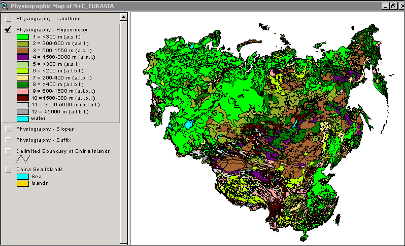
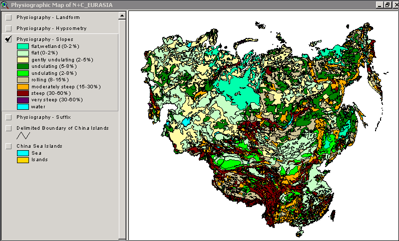
1) Comprehensive read.me for Physiographic Database (Phyread.rtf), which is an explanation file for the Physiographic Map of North and Central Eurasia
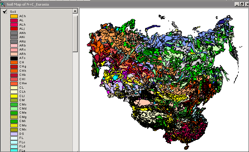
2) Comprehensive read.me for Soil Database (Soilread.rtf), which is an explanation file for the Soil Map of North and Central Eurasia
3) Coverage Description (Readme.xls), which shows each coverage and source, for themes in Nceurasia.apr and Russia.apr
4) Zitong, Gong, Zhou Huizhen, Shi Zuezheng and Luo Guoboa. Soils of China 1999 (Chinafin.doc), which provides documentation for the Soil Map of China
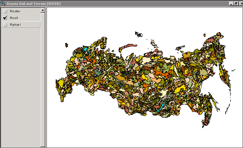
5) Georeferenced Database of Russia. Volumes 1 and 2: Soil and Terrain Digital Database (SOTER) (Ru_soter.doc), which provides documentation for the Soil and Terrain database and the Physiographic Map of Russian Federation.
6) Soils of Russia: Correlated with the Revised Legend of the FAO Soil Map of the World (Ru_soil.doc), which provides documentation on the Soil Map of Russian Federation
7) Stolbovoy, V. Physiographic Map of the CIS, Baltic States and Mongolia (at scale 1:5million) (CISBSMO_phy.doc), which provides documentation on the physiographic map of the CIS, Baltic States and Mongolia
8) van Lynden, G.W. Draft Physiographic Map of Asia (Excl. CIS and Baltic States) August 1999 (CH_phy.doc), which provides documentation on the physiographic map of China and the Taiwan Province of China.
A paper copy of all of these documents is available in the Map Collection. Attribute Fields in These Data Files:
Demo Location:
The two ArcView projects which are supplied on the CD-ROM (nceurasia.apr and russia.apr) are available as demos, on the ArcView workstation in the Map Collection.
H:/data demos/FAO/Eurasia/eurasia_demo.apr
H:/data demos/FAO/Eurasia/russia_demo.apr How to Obtain These Files:
1) "Data contained in this product may... be used freely provided that FAO is cited as the source." (Cover booklet)
2) The CD-ROM is available for loan to McMaster researchers and students, with valid ID.
3) Request the CD-ROM from the Map Collection in Mills Library Room 110. The call number for the CD-ROM is UN9 FA5 99S07. Index
Hamilton Index
| ||||||||||||||||||||
| Contact:
mapref@mcmaster.ca
|