
|
| Lloyd Reeds Map Collection |
| Geospatial Data Available from the McMaster University Library |
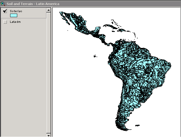
Soil and Terrain Database for Latin America and the Caribbean
Source:
United Nations. Food and Agriculture Organization (FAO). Soil and Terrain Database for Latin America and the Caribbean (1:5 million scale). [CD-ROM]. FAO Land and Water Digital Media Series #05. 1998. Description:
Part of a global project to inventory soils. This CD-ROM contains reports, databases and digital maps for Latin America and the Caribbean (covering Mexico, the Caribbean Islands and all of South America).
Map file formats: ArcInfo export format (.e00). Attribute tables in Paradox and .dbf formats.
The CD-ROM includes two geographical boundary files (Soterlac, Soil and Terrain and Latadm, Administrative Divisions) and a number of attribute tables which can be joined.
The Soil and Terrain (SOTER) data includes the Caribbean Islands. The administrative division boundary file (latadm) includes only Central and South America - the Caribbean Islands are not included. Metadata:
There are a number of metadata document files available on the CD-ROM, including:
1) Readme.1st document, which shows the directory structure and contents of the CD-ROM.
2) Completion of a 1:5 million Soil and Terrain Digital Database (SOTER) for Latin America and the Caribbean (SOTERLAC) 1993-1997: Terminal Report (Soterrep.doc), which describes the process of creating the Soil and Terrain database.
3) Coverage of Latin America - Administrative Divisions (Latadm/Readme.doc), which describes the authorship of the administrative divisions boundary file Latadm.
4) Latin America Administrative Units Map of CIAT (Latadm/Latadm.doc), which documents updates to the administrative divisions boundary file as of 14 July 1998.
5) FAO Coding System for Subnational Administrative Unit GIS Maps (Latadm/Faocode.doc), which is an file explaining the codes for all levels of administrative units in the Latadm boundary file.
Attribute Fields in These Data Files:
Demo Location:
An ArcView project is available as a demo of this data, on the ArcView workstation in the Map Collection.
H:/data demos/FAO/Latin America/demo.apr How to Obtain These Files:
1) The CD-ROM is available for loan to McMaster researchers and students, with valid ID.
2) Request the CD-ROM from the Map Collection in Mills Library Room 110. The call number for the CD-ROM is UN9 FA5 98S05. Index World Index Geospatial Data Geography Index
| ||||||||||||
| Contact:
mapref@mcmaster.ca
|