
|
| Lloyd Reeds Map Collection |
| Geospatial Data Available from the McMaster University Library |
Digital Cartographic Reference Base
|
|
|
|
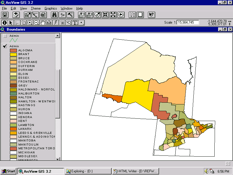
| Boundaries - Admin (counties and regional municipalities) (Sample) |
name, mtocode, date entered, source |
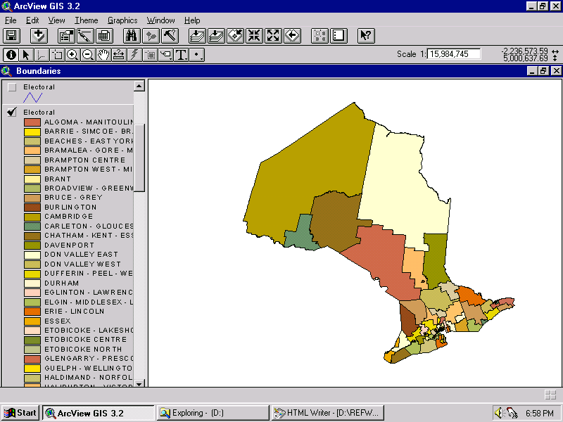
| Boundaries - Electoral (provincial ridings) (Sample) |
riding name, riding number |
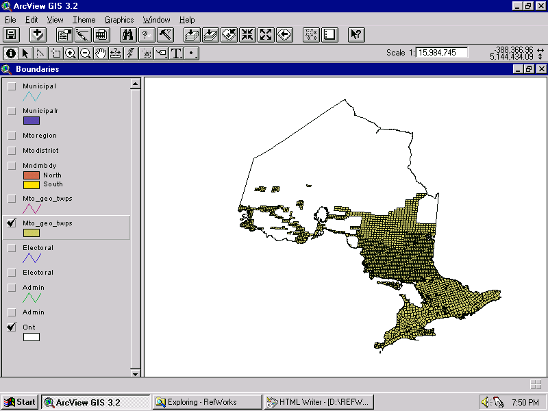
| Boundaries - Mto_geo_twps (geographical townships) (Sample) |
mto_geo_twps-id, mnr_gtwpid, name, mtocode, date entered, source |
| Boundaries - Mndmbdy (Northern and Southern Ontario) |
- |
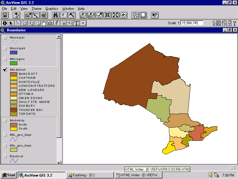
| Boundaries - Mtodistrict (Ministry of Transportation districts) (Sample) |
mtodist_num, mtoreg_name, mtocode, date entered, mtodist_name |
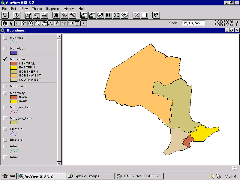
| Boundaries - Mtoregion (Ministry of Transportation regions) (Sample) |
mtoreg_name, mtocode, date entered, mtoreg-id |
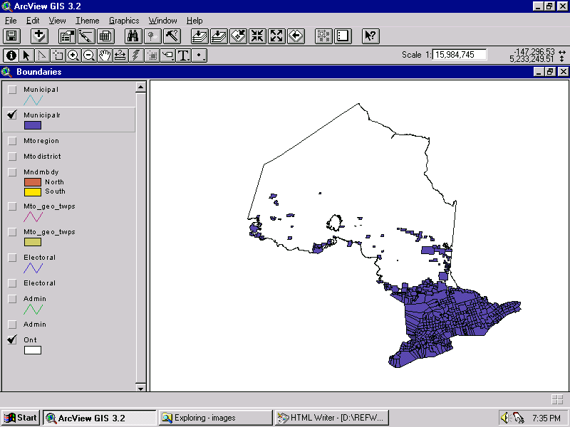
| Boundaries - Municipalr (municipalities) (Sample) |
mtocode, name, pop, road_sign, date_entered, source, source_dat, comment, pop_source |
| Communities (1809 points) | community, commpt_lam, commpt_lama, mtocode, name, pop, road_sign, date_enter, date_retir, source, source_dat, comment, pop_source |
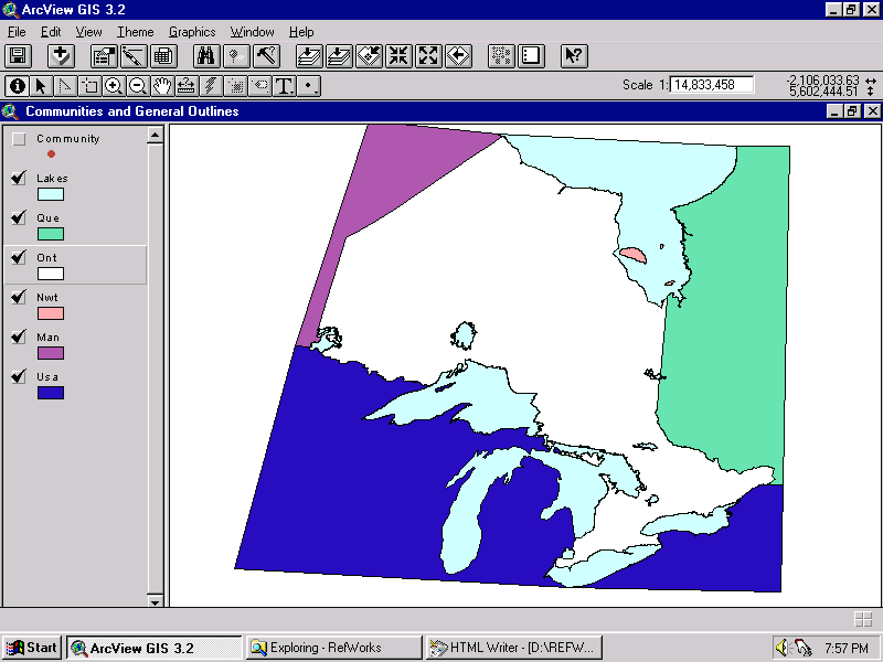
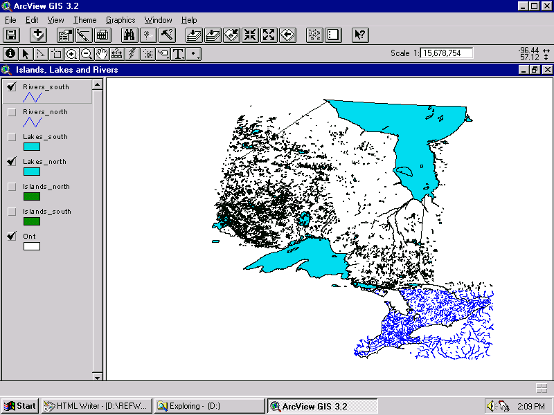
| General outlines - Lakes, Ont, Que, Man, NWT, USA (Sample) | - |
| General point features - Airports (123 points) |
mtocode, date_entered, source, comment, airport_name, class |
| General point features - Border_xing (border crossing - 18 points) |
mtocode, date_entered, source, source_date, crossing |
| General point features - Carpool_lot (59 points) |
mtocode, date_entered, source, source_date, comment, lot_num, owner |
| General point features - Medical_ctr (medical centre - 217 points) |
mtocode, date_entered, source, source_date, comment, med_name, service, location |
| General point features - Mtopicnic_pk (Ministry of Transportation picnic park - 154 points) |
mtocode, date_entered, source, source_date, name, site_num |
| General point features - Opp_station (Ontario Provincial Police station - 212 points) |
mtocode, date_entered, source, source_date, comment, detachment, opp_name, class |
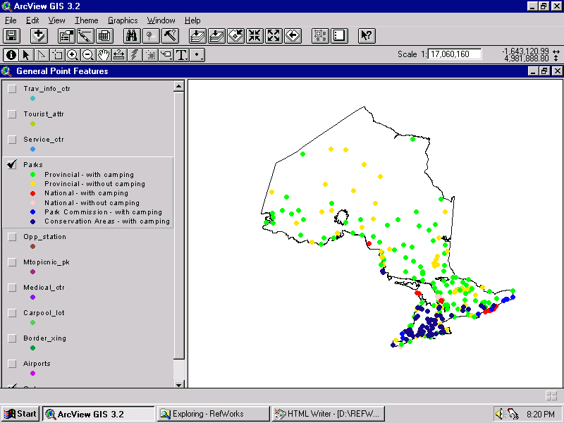
| General point features - Parks (274 points) (Sample) |
mtocode, date_entered, source, source_date, comment, park_name, authority, camping |
| General point features - Service_ctr (Highway service centre - 25 points) |
mtocode, date_entered, source, source_date, comment, station_name, site_num |
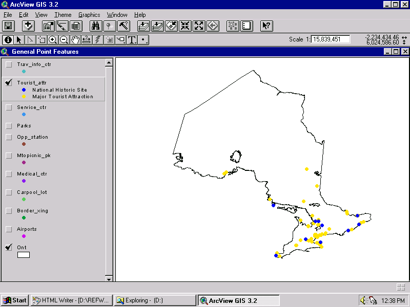
| General point features - Tourist_attr (tourist attraction - 74 points) (Sample) |
mtocode, date_entered, source, source_date, comment, name, location |
| General point features - Travel_info_ctr (travel information centre - 27 points) |
mtocode, date_entered, source, source_date, comment, location, open, operator |
| Index maps - Mtmzones | zone, cent_mer |
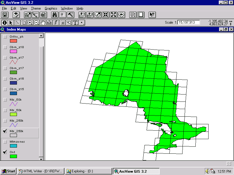
| Index maps - Nts250k (National Topographic System 1:250,000 grid) (Sample) |
nts_num, nts_name |
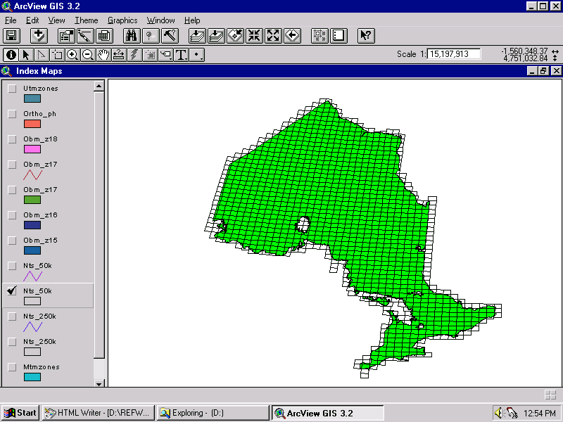
| Index maps - Nts50k (National Topographic System 1:50,000 grid) (Sample) |
nts_num, nts_name |
| Index maps - Obm_z15 (Ontario Base Map grid, UTM zone 15) |
obm_num |
| Index maps - Obm_z16 (Ontario Base Map grid, UTM zone 16) |
obm_num |
| Index maps - Obm_z17 (Ontario Base Map grid, UTM zone 17) |
obm_num |
| Index maps - Obm_z18 (Ontario Base Map grid, UTM zone 18) |
obm_num |
| Index maps - Ortho_ph (Orthophoto grid) |
disk_num, filename |
| Index maps - Utmzones (Universal Transverse Mercator grid zones) |
zone, cent_mer |
| Islands - Islands_north (329 polygons) |
mtocode, date_entered |
| Islands - Islands_south (421 polygons) |
mtocode, date_entered |
| Lakes and Rivers - Lakes_north (3595 polygons) (Sample) |
mtocode, date_entered, source |
| Lakes and Rivers - Lakes_south (931 polygons) |
mtocode, date_entered, source |
| Lakes and Rivers - Rivers_north | mtocode, date_entered |
| Lakes and Rivers - Rivers_south (Sample) |
mtocode, date_entered |
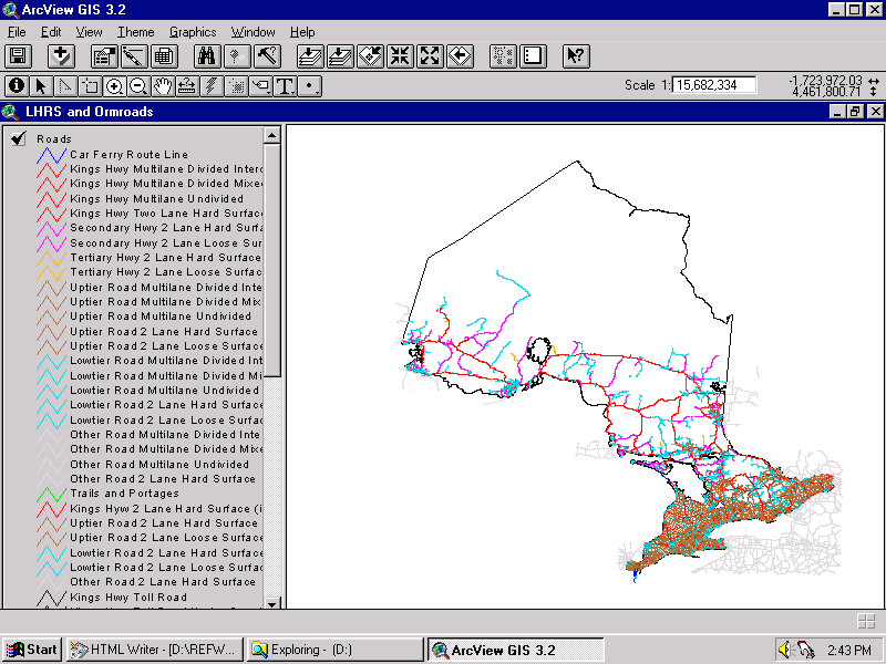
| LRHS - Lhrs (Linear Highway Referencing System points) |
reference_no, description, hwy, stop_order, X-coord, Y-coord, section_length, sec_len, from, to, roads-id, route#, lhrssect, distance |
| Ormroads - Hwys (highways from Ontario Road Map) |
very slow file, extract from Roads coverage instead |
| Ormroads - Roads (roads from Ontario Road Map) (Sample) |
mtocode, date_entered, date_retired, source, source_dat, source_loc, route_num (incomplete), route_num2 |
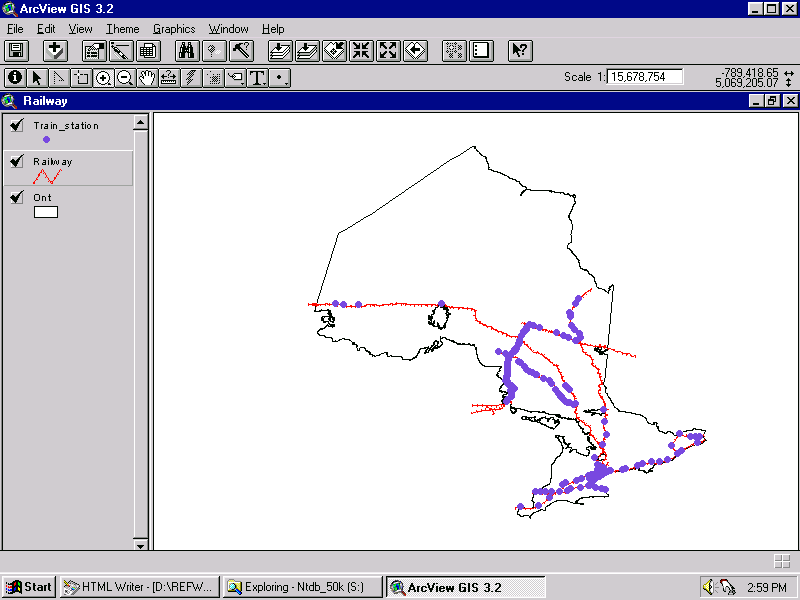
| Railway - Railway (Sample) | mtocode, date_entered, source, source_dat |
| Railway - Train_station (Sample) | mtocode, date_entered, source, source_dat, comment, sta_name, service, corridor |
H:\data demos\dcrbversion2.0\demo.apr (CD-ROM is needed to load the demo - ask staff for assistance)
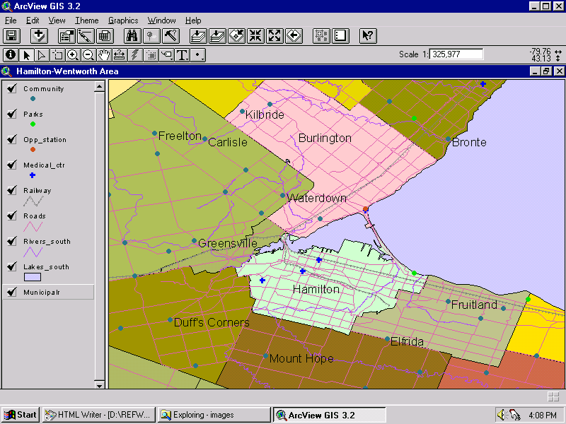
The example below shows a close-up of the Hamilton area, with several different coverages displayed.
Contact:
mapref@mcmaster.ca
Last Reviewed: July 5, 2005
URL: