Shuttle Radar Topography Mission (SRTM)
Digital Elevation Model data
Source:
LandInfo Worldwide Mapping LLC. Shuttle Radar Topography Mission
(SRTM).
Mission was flown aboard the NASA Space Shuttle Endeavour February
11-22, 2000. This version of the SRTM data was purchased by LandInfo
Worldwide Mapping from the United States Geological Survey in July 2005.
Index
Description:
Digital elevation model images (DEMs) for most of the earth, excluding
north and south polar areas.
Shuttle Radar Topography Mission is a joint project between the United
States National Aeronautics and Space Administration (NASA) and National
Geospatial Intelligence Agency (NGA). The SRTM project utilized dual
Spaceborne Imaging Radar (SIR-C) and dual X-band Synthetic Aperture
Radar (X-SAR) to acquire two images simultaneously. When combined, these
two images produce a single three-dimensional image.
SRTM data has been used to produce digital topographic images of the
Earth's land surface with data points spaced every 3 arc seconds (approximately
90 metres). Digital elevation images are available for about 80% of
the earth's land surface, for all areas between 60 degrees North and
56 degrees South latitude. There are some void areas in the tropics
and mountainous areas where the terrain lay in the radar beam's shadow
or in areas of extremely low radar backscatter.
There are two resolutions of image available: 3 second arc tiles and
30 second arc tiles. The 30 second arc tiles are produced by averaging
of the more detailed data tiles.
An auxiliary product, produced from the SRTM images, is Water Body
Data. These files are a by-product, where the terrain elevation
data has been edited to portray water bodies that meet minimum capture
criteria (islands with length > 300 metres, lakes with length > 600
metres, rivers with width > 183 metres).
Projection = Geographic (Latitude/Longitude)
Datum = World Geodetic System (WGS84)
File format:
- SRTM Digital Elevation Model data is in BIL (simple binary
raster) format.
- Water Body Data is in ESRI shapefile format.
- The SRTM Digital Elevation Model data in 30 second arc tiles
are also available in image formats as .gif and .jpg.
Index
Metadata:
LandInfo Worldwide Mapping LLC. Seamless
Shuttle Radar Topography Mission (SRTM) "Finished" 3 Arc Second (~90
meter).
LandInfo Worldwide Mapping LLC. SRTM30
Documentation. [30 Arc Second product]
For more information on the Shuttle Radar Topography mission, see http://srtm.usgs.gov/
LandInfo Worldwide Mapping LLC. Documentation
for the Shuttle Radar Topography Mission (SRTM) Water Body Data Files.
LandInfo Worldwide Mapping LLC. SRTM
Water Body Data Product Specific Guidance.
Paper copies of these documents are also available in the Map Collection.
Index
Attribute Fields in These Data Files:
There are no attributes associated with Digital Elevation Model data,
except the elevation value assigned to each pixel (in metres).
Attributes associated with Water Body Data shapefiles: Facc_code,
Cell, Wb
Index
Demo Location:
Samples of the Shuttle Radar Topography Mission and Water
Body Data files may be viewed in the Map Collection.
H:/data_demos/landinfo/demo.apr (View = Shuttle Radar Topography
Mission for indexes and Water Body Data sample)
H:/data_demos/landinfo/SRTM.mxd (ArcMap demo for SRTM images
and Water Body Data sample)
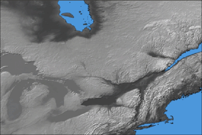
Sample of SRTM 30 second arc
DEM - Southern Ontario tile W100n90
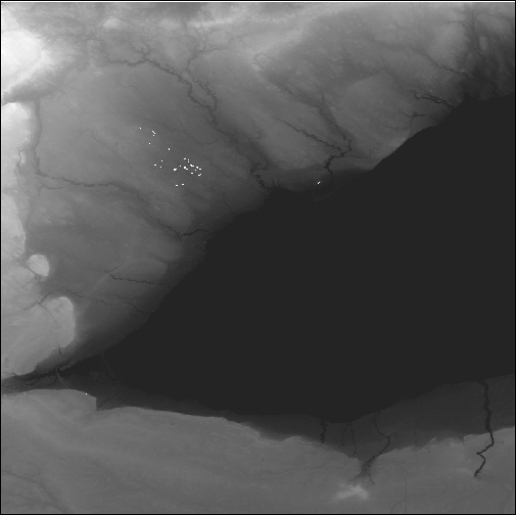
Sample of SRTM 3 second arc
DEM, black and white - Hamilton area tile Area1 n43w080
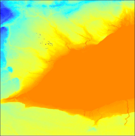
Sample of SRTM 3 second
arc DEM, colour shading - Hamilton area tile Area1 n43w080
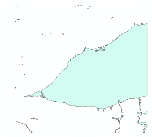
Sample of Water Body Data
- Hamilton area tile West w080n43
Index
How to Obtain These Files:
1) These Shuttle Radar Topography Mission and Water Body
Data files are the copyrighted property of LandInfo Worldwide Mapping
LLC. They are available only to students, faculty and staff of McMaster
University, and may be used only for educational and non-commercial purposes.
2) These files can be requested from the Map Collection by tile number.
The DEM tiles and the Water Body Data shapefiles are numbered
according to the latitude and longitude of the southwest corner of each
tile.
For SRTM data, specify whether you want 30 second arc or 3 second arc
tiles, and the format required (.BIL, .GIF or .JPG).
A detailed index showing tile numbers is available in the Map Collection
(data demo).
Index
Ontario Index
Canada Index
World Index
Geospatial Data Geography Index
|
