
McMaster University Library | Aeronautical Charts Index
WELCOME
A Guide to the McMaster University Library's World War II Aeronautical Charts Index
❮
❯
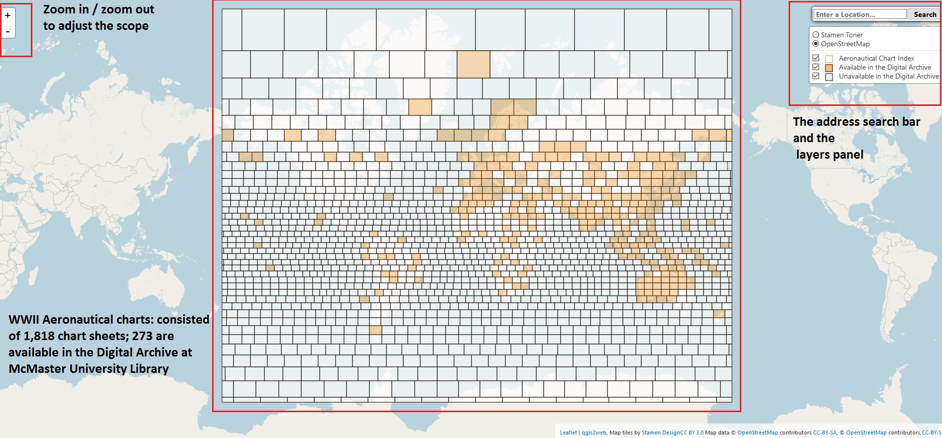

Welcome to McMaster University Library’s World War II Aeronautical Charts Index -- An interactive tool for finding and accessing World War II era 1:1 million U.S. American Air Forces (AAF) Aeronautical Charts. Features of this index along with the aeronautical charts include a zooming tool, a search box, and the layer panel.
Close this window (or click on the map) to begin exploring.
Close this window (or click on the map) to begin exploring.
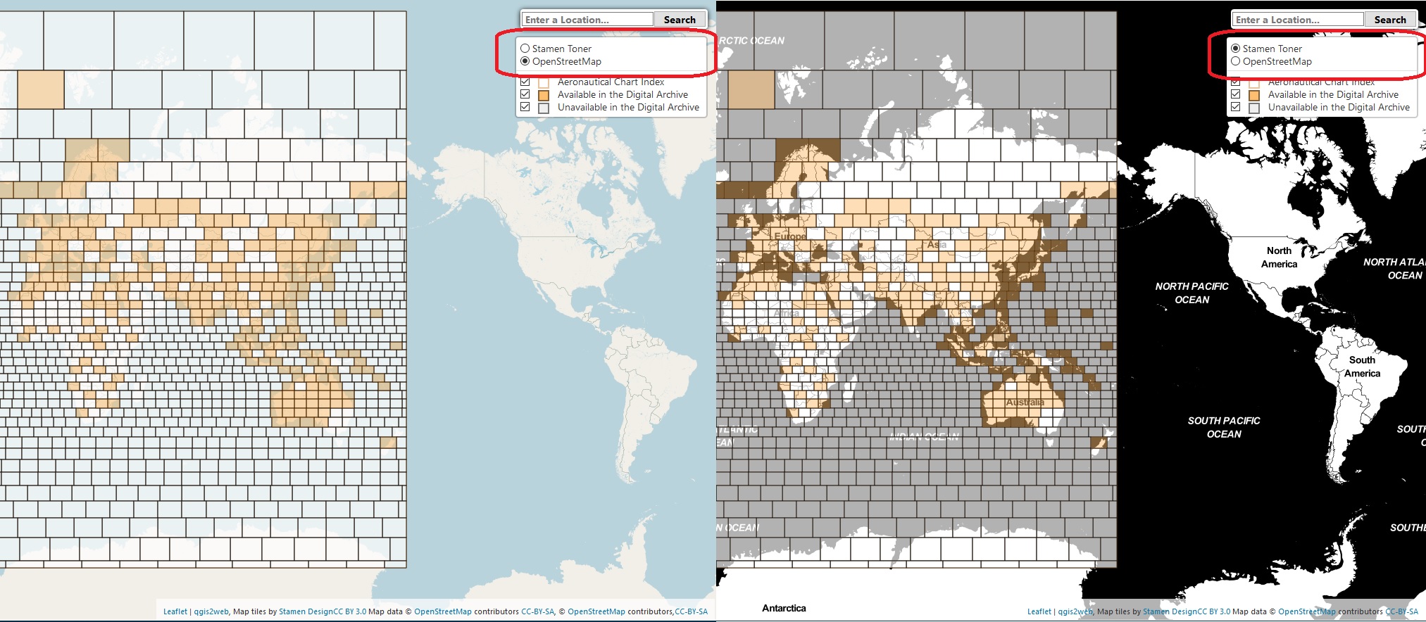
Change the base map using the layer panel on the right.
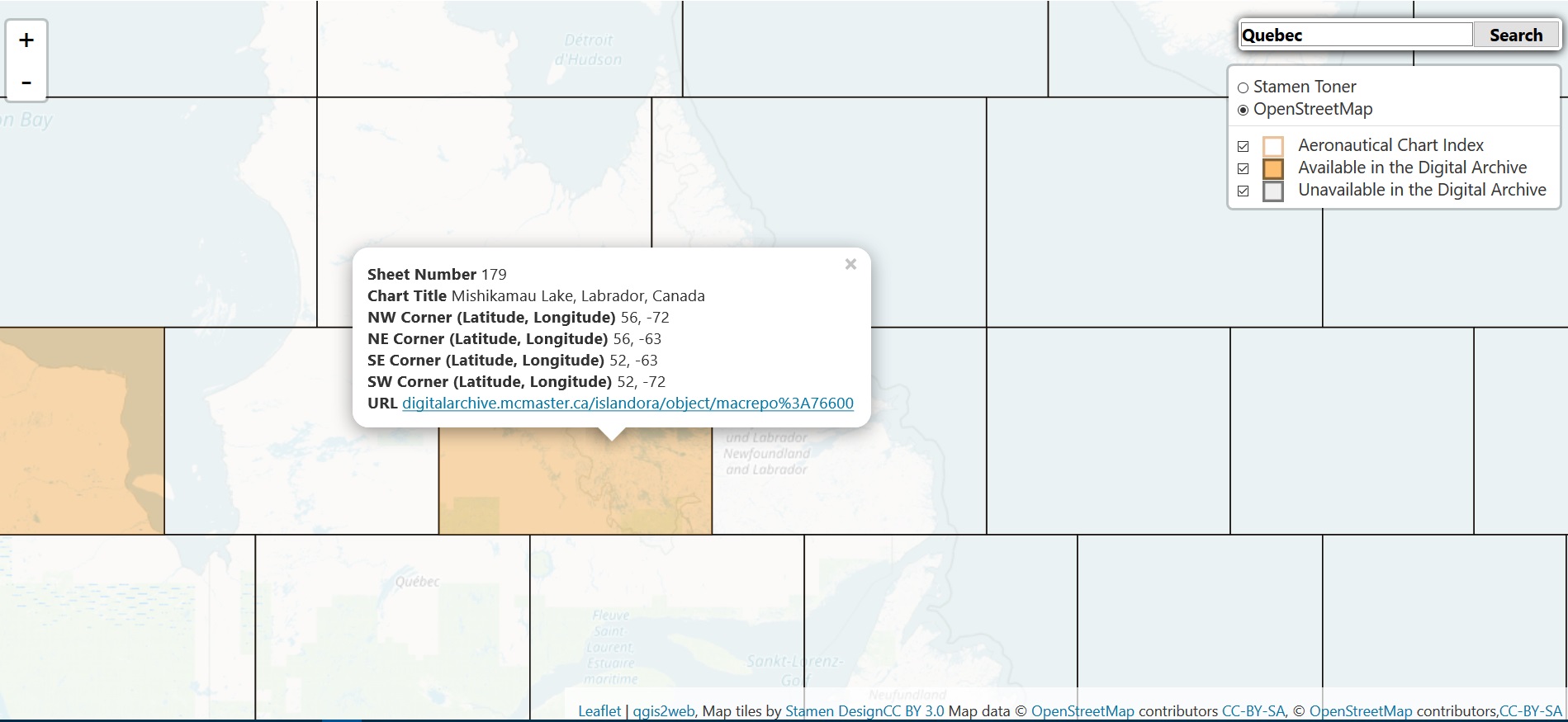
Find and zoom to an area of interest by performing an address search in the search box.
Click on a grid square to find more information on a given chart. An orange shaded grid square indicates that a digital version is available for viewing.