Breadcrumb
Geospatial Data
| Title | Author | Year Sort descending | Sample |
|---|---|---|---|
| Ontario Toponymic Database (OTDB) | Ontario Ministry of Natural Resources | 1500 - 2007 | |
| Geographic Named Extent | Ontario Ministry of Natural Resources | 1500 - 2011 | 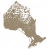
|
| Global Historical Climatology Network (GHCN) Global Daily Climate Data | NOAA National Centers for Environmental Information |
1763 - present | |
| Species Occurrence, Provincially Tracked | Ontario Ministry of Natural Resources | 1777 - 2012 | |
| Indian Reserve | Ontario Ministry of Natural Resources | 1800 - 2008 | 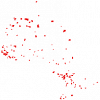
|
| Petroleum Pool | Ontario Ministry of Natural Resources | 1858 - 2003 | 
|
| Petroleum Well | Ontario Ministry of Natural Resources | 1858 - 2009 | 
|
| Borehole - Retired | Ontario Ministry of Northern Development, Mines and Forestry | 1875 - 2010 | 
|
| Toronto Fire Insurance Plans | Charles E. Goad |
1884 - 1910 | |
| Provincial Park Regulated | Ontario Ministry of Natural Resources | 1893 - 2008 | 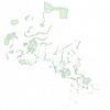
|
| Water Resources Information Program (WRIP) Water Well Locations Phase 3 | Ontario Ministry of Natural Resources | 1899 - 2006 | 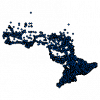
|
| Research Plot | Ontario Ministry of Natural Resources | 1900 - 2006 | 
|
| Fisheries Data Catalog | Ontario Ministry of Natural Resources | 1900 - 2010 | 
|
| Historical Topographic Maps: 1:63,360 Index | Geographical Section, Department of National Defence | 1906 - 2016 | |
| City of Toronto Fire Insurance Plans (1910) - Georeferenced | Original maps by Goad's Atlas and Plan Co. (Goad, Charles E.) Georeferenced by McMaster University Lloyd Reeds Map Collection |
1910 | |
| Niagara Air Photo Index | Canada Department of Energy, Mines & Resources |
1921 - 2020 | |
| Soil Survey Complex | Ontario Ministry of Agriculture, Food, and Rural Affairs | 1929 - 2003 | 
|
| Waterloo Region Historic Air Photo Collection | Unknown | 1930, 1945-47, 1955, 1963 and 1966 | |
| 1934 Air Photos of Niagara Region | Canada Department of Energy, Mines, and Resources | 1934 - 2017 | 
|
| Assessment File Research Image (AFRI) Database | Ontario Ministry of Northern Development and Mines | 1940 - 2009 | 
|
Pagination
- Page 1
- Next page
