Year
1945
Abstract
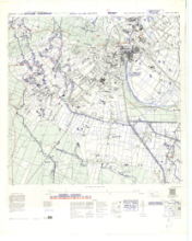
This is a 1:12,500 scale map (defence overprint) of the region of Cleve, Germany. It is the first edition of this map, published on February 2, 1945 by the Royal Canadian Engineers.
This overprint utilizes the Nord de Guerre Zone Grid (Blue) and is referenced from air photographs taken January 24, 1945, and ground information taken January 31, 1945.
Production information for the map is 8M/1/45/3RCE/5556. Production information for the overprint is 8M/2/45/3RCE/5611.
URL
Access this resource on Scholars Geoportal.
Scholars Geoportal URL
Access this resource on Scholars Geoportal.