McMaster University Library | Historical Hamilton Portal
x
WELCOME
A Guide to the McMaster University Library's Historical Hamilton Portal
❮
❯


Welcome to the McMaster University Library's Historical Hamilton Portal -- An interactive tool for finding and accessing aerial photos, fire insurance plans and other cartographic materials for the Hamilton area.
Close this window (or click on the map) to begin exploring.
Close this window (or click on the map) to begin exploring.

The central location of each aerial photo in the collection is identified with a marker.
Where available, boundaries of aerial photos are indicated for each marker.
Explore our collection by navigating the map and using the time slider to select a year of interest.

Click on a marker for more information on an aerial photo, including an image preview, a link to a digital version, and the photo's geographic envelope highlighted in yellow, if available.

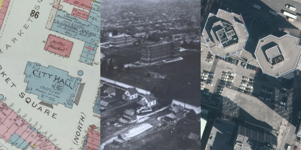
Explore a historic fire insurance plan layer by selecting it on the navigation panel.
To view the fire insurance plan's citation, click anywhere on the plates of the plan.

View a modern orthoimagery layer by selecting it on the navigation panel.
Note: This feature is available only to McMaster users.
Note: This feature is available only to McMaster users.

Explore historic topographic maps by selecting its layer on the navigation panel. Slide the time slider across years to view the most recent available topographic maps for the selected year.
To view the map's citation, click anywhere on the topographic map.

View aerial photo envelopes by selecting it on the navigation panel. Hover over locations to highlight an area and view the extent of geography the aerial photo collection covers. Slide the time slider across years to view available envelopes for the selected year.

Use the opacity slider to blend layers together.